How to drive the unpaved track to Sant Alís in the Serra del Montsec?
Sant Alís is the highest peak in the Serra del Montsec d'Ares, sitting at 1,676m (5,499ft) above sea level. This dirt track in Lleida is the only way to reach the summit, a place where everyone goes to fly. It’s not a long route, but the terrain and the local traffic mean you can’t let your guard down for a second.
| Road facts: Sant Alís | |
|---|---|
| Location | Lleida, Catalonia (Spain) |
| Elevation | 1,676 m (5,499 ft) |
| Length | 2.5 km (1.5 miles) |
| Average Gradient | 5.64% |
| Surface | Unpaved / Dirt and stones |
Where is the road to Sant Alís?
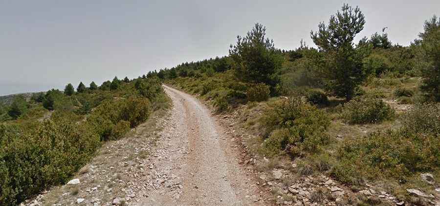
The track starts at Coll d'Ares, right on the border between the Noguera and Pallars Jussà regions. This 2.5 km route climbs along the spine of the Montsec and is the path used by paragliders and hang-gliders to reach the take-off point. This means you’ll find vans going up and down all the time loaded with people and gear. Since the path is very narrow and there’s almost nowhere to pull over, crossing another vehicle is a serious problem if you don't know exactly where to make the move.
Is the road to Sant Alís unpaved?
Yes, it’s a dirt and loose stone track from start to finish. While it’s not an impossible climb, a 4x4 vehicle is more than recommended. The ground is quite worn down by the constant shuttle vans, and there are sections where the loose rocks make it very slippery. Also, if you’re carrying paragliding equipment or bulky gear on the roof, watch out for the strong wind gusts of the Montsec; the car acts like a sail and side winds can jerk the steering wheel badly in the more exposed areas.
How long is the drive through Sant Alís?
From Coll d'Ares to the summit is only 2.5 kilometers, but don’t think it’ll be a quick trip. With an elevation gain of 141 meters and a 5.6% average gradient, driving is slow. You have to be careful not to hit the undercarriage of the car on some deep ruts and keep traction on the steeper ramps. It’s not a road for speeding; it’s about taking it steady, especially if you meet someone coming the other way on one of the sections where the track hangs over the edge.
Is the road to Sant Alís open in winter?
You can usually drive up most of the year, but in winter, things change fast. At 1,676 meters high, snow and ice appear often and can block the way in hours. Even if the valley looks clear, snow can pile up on the track at the top. If it has snowed recently, don’t go up without chains or winter tires, because once you get stuck on the ridge of the Montsec, there aren't many places to turn around and head back down.