Road to Puig Neulós: Driving the 1,251m Border Peak in the Albera Range
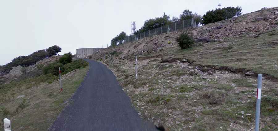
Puig Neulós is a mountain peak at an elevation of 1,251 meters (4,104 ft) above sea level, located on the international border between France (Pyrénées-Orientales) and Spain (Girona). Situated as the highest point of the Albera Range, the summit features high-power telecommunication antennas accessible via a narrow paved road climbing the northern slope.
| Road facts: Puig Neulós | |
|---|---|
| Location | French-Spanish Border (Albera Range) |
| Elevation | 1,251 m (4,104 ft) |
| Length | 6.5 km (4.04 miles) |
| Elevation Gain | 686 meters |
| Average Gradient | 10.55% |
| Surface | Paved (Narrow asphalt) |
How steep is the road to Puig Neulós?
The final asphalt climb begins at a junction past the Col de l'Ouillat (Coll de l'Ullat), at 565 meters above sea level. Over a distance of 6.5 kilometers, the road climbs 686 vertical meters up to the summit antennas. The pitch maintains a severe average gradient of 10.55%, with sustained steep ramps that overheat brakes quickly during the descent. The asphalt runs through dense beech and pine forests, leaving the surface frequently covered in moss, wet leaves, and loose twigs.
What are the main hazards on the Puig Neulós road?
The roadway is extremely narrow, barely exceeding the width of a single car, with no central lane markings or guardrails along the edge of the steep drop-offs. Because the ridge sits only 10 kilometers away from the Mediterranean Sea, the upper exposed sections are regularly hit by the Tramuntana, a violent northern wind that can shake vehicles. Shaded corners stay damp all day, and thick sea fog frequently drops visibility to zero near the peak.
Are there access restrictions at the Puig Neulós summit?
The narrow roadway dimensions and tight switchbacks make the route entirely impassable for motorhomes, caravans, or long trucks. While generally open to light traffic, a metal barrier near the top is closed by authorities during winter snowfalls or during periods of extreme summer fire risk. The final area around the high-power radio masts is fenced off, leaving no room to turn around or park if the mountain gate is locked.