Fuentes Altas: A scenic off-road track through the heart of Cazorla
Fuentes Altas is a high mountain pass at an elevation of 1,736m (5,695ft) above sea level, located in the Sierras de Cazorla, Segura y Las Villas Natural Park, in the province of Jaén, Andalusia, in Spain.
Where is Fuentes Altas located?
The pass is situated in the northeastern sector of the Jaén province, specifically within the largest protected area in Spain. The route traverses a high-altitude limestone plateau that connects the settlement of Vites with the Alto de Despiernacaballos viewpoint.
| Road facts: Fuentes Altas | |
|---|---|
| Elevation | 1,736 m (5,695 ft) |
| Distance | 14.1 km (8.76 miles) |
| Max Gradient | 9% |
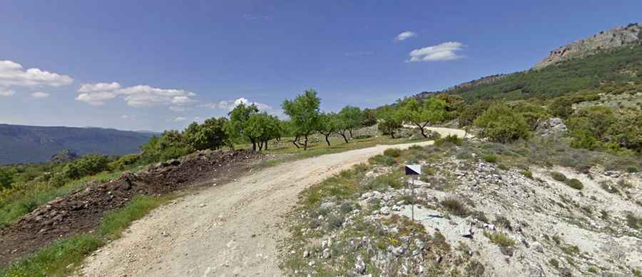
| Surface | Unpaved / Gravel |
What are the road conditions to Fuentes Altas?
The road is entirely unpaved and follows a traditional forest management track. The surface is composed of loose gravel and rock, which can become muddy and slippery during the autumn and winter seasons. At an elevation of 1,736 meters, snow is a common obstacle from December to March, often rendering the track impassable.
Is a 4x4 required for Fuentes Altas?
While the maximum gradient is a relatively steady 9%, the technical condition of the track—characterized by narrow sections and uneven terrain—makes a high-clearance 4x4 vehicle highly recommended. Standard passenger vehicles may struggle with traction, especially on the "tippy" sections of the plateau.
Technical Connections
The track serves as a strategic link in the Segura mountain range. It is part of a larger network of forest roads that allow access to remote interior areas of the park, far from the primary tourist routes of the Guadalquivir valley.