Driving to Mirador del Tapadero: 20 hairpins in the heart of Jaén
Located deep within the Sierras de Cazorla, Segura y Las Villas National Park, in the province of Jaén, the ascent to Mirador del Tapadero is a technical challenge that defines the raw nature of high-mountain driving in Andalusia. Reaching an elevation of 1,124m (3,687ft) above sea level, the road—known as the Transversal de las Villas—is a narrow ribbon of asphalt carved into the rock. It is a drive where the mechanical demand of the hairpins meets the psychological pressure of a 200-meter vertical drop just inches from your tires.
| Road facts: Mirador del Tapadero | |
|---|---|
| Location | Villanueva del Arzobispo, Jaén (Spain) |
| Elevation | 1,124 m (3,687 ft) |
| Road Name | Transversal de las Villas |
| Length | 9.7 km (from A-6202) |
| Hairpin Turns | 20 |
Where is Mirador del Tapadero?
The viewpoint is situated in the eastern part of the province of Jaén, within one of the largest protected natural areas in Spain. To reach the Mirador del Tapadero, you must navigate the Transversal de las Villas, a mountain road that feels more like a paved ledge than a provincial route. The outcrop of rock where the viewpoint sits is a natural balcony over a chasm that drops 200 meters straight down. This is an area of absolute isolation, where the only thing between your vehicle and the abyss is your precision at the wheel.
Is the road to the summit paved?
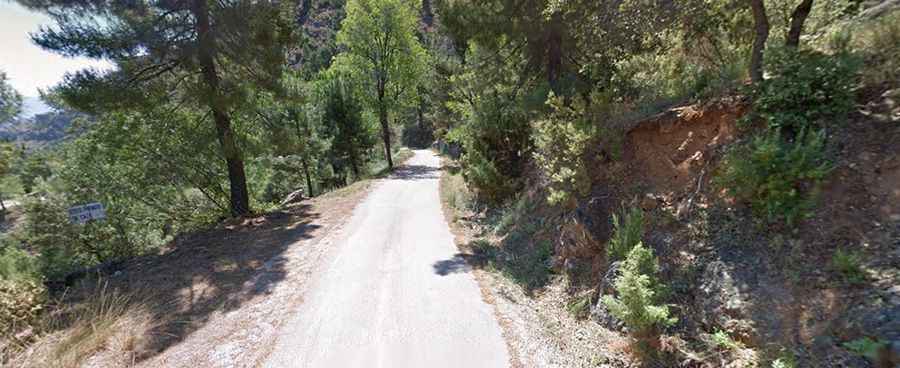
The road is paved, but it is extremely narrow. In many sections, the asphalt is barely wider than a single vehicle, making it nearly impossible for two cars to pass each other without one having to reverse to a wider spot. As seen in the local terrain, the road is battered by falling rocks and debris from the limestone walls above. You must drive with extreme care; the pavement is technical and features dangerous drops that are completely unprotected. There are no guardrails in the most critical sections, and the psychological impact of the dizzying heights is a factor every driver must manage.
How long and steep is the ascent to Tapadero?
Starting from the A-6202 road, the climb is 9.7 km long with an elevation gain of 572 meters. While the average gradient is 5.89%, the real difficulty lies in the 20 hairpin turns that characterize the route. These turns are tight and technical, often requiring first-gear maneuvers to clear them safely. The constant directional changes mean your steering system is under heavy load for the entire duration of the climb. The verticality is relentless, and because the road is so narrow, you must constantly scan the path ahead for local park rangers or livestock that frequent these ridges.
How do you manage the descent with such dangerous dropoffs?
Coming down from 1,124m toward the valley is a test of braking discipline. The 20 hairpins and the proximity to the 200-meter drop-off leave zero margin for error. If you rely too much on your foot brakes, the constant technical turns will quickly lead to overheating. The best strategy is to engage heavy engine braking to keep your speed under absolute control. Watch the inner side of the road for sharp rocks that fall from the cliffs, as a puncture on such a narrow, exposed ledge can turn a simple drive into a logistical disaster. It is a route that demands full focus—keep your eyes on the asphalt, respect the verticality, and never trust the soft shoulders of the road.