How to drive the 4x4 track to Coll de Finestres?
Coll de Finestres is an international high mountain pass at an elevation of 2,392m (7,847ft) above sea level, located on the border between Andorra (Sant Julià de Lòria) and Spain (Lleida). Logistically, it is one of the highest driveable points in the Pyrenees, situated in the southern sector of the Rabassa massif. The route demands high-altitude driving experience and a vehicle specifically prepared for degraded mountain tracks.
| Road facts: Coll de Finestres | |
|---|---|
| Location | Andorra (Sant Julià de Lòria) - Spain (Lleida) |
| Elevation | 2,392 m (7,847 ft) |
| Length | 2.4 km (from Coll de Pimés) |
| Average Gradient | 11.75% |
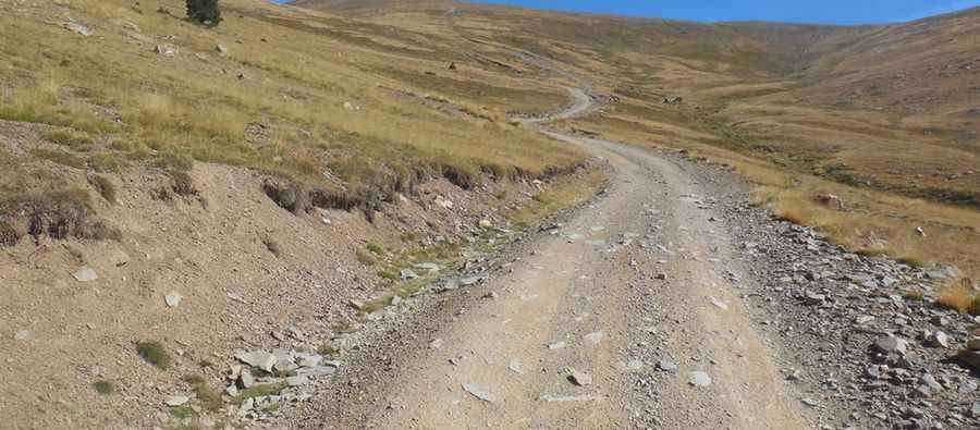
What is the technical difficulty of the road to Coll de Finestres?
The ascent to Coll de Finestres starts at Coll de Pimés. The track is 2.4 km long, covering an elevation gain of 282 meters. Technically, the average gradient of 11.75% is very high for an unpaved surface, requiring constant traction management. Logistically, a high-clearance 4x4 vehicle is mandatory. The roadbed consists of loose stones and high-altitude soil that becomes extremely slippery during the thaw. Precise gear selection is necessary to maintain momentum without spinning the wheels on the steepest ramps. It’s one of the highest roads in the country.
What are the seasonal hazards at Coll de Finestres?
Logistically, the pass is impassable in winter due to heavy snow accumulation and its high elevation of 2,392m. Technically, the road is not maintained for winter transit, and snowbanks can persist well into late June. Safety protocols mandate checking weather forecasts for the Pyrenees before starting the climb, as sudden storms can cause rapid erosion on the track. During the summer, the primary hazard is the sharp schist rock that can damage tire sidewalls. High-altitude winds are common at the summit, where the track narrows significantly near the border markers.
How to manage vehicle logistics on the Andorra-Spain border track?
Technically, the Coll de Finestres road is a high-mountain transit corridor used by forestry services and border patrols. Logistically, there are no refueling or mechanical support points between Sant Julià de Lòria and the summit. Drivers must ensure the vehicle's cooling system is functioning correctly, as the combination of 11.75% gradients and lower oxygen levels at 2,392m increases the thermal load on the engine. The descent requires heavy use of engine braking to prevent brake system overheating on the technical sections back toward Coll de Pimés.
Pic: http://www.pirineos3000.com/servlet/DescripcionAscension/MONTANA--Pic%20Negre%20de%20Claror--IDASCENSION--26176.html