Is the road to Pic d'Espadà in Castelló difficult to drive?
Reaching the Pic d'Espadà is a journey into one of the wildest corners of the Valencian Community. At 915m (3,001ft) above sea level, this peak in the heart of the Serra d'Espadà Natural Park offers some of the most rugged driving in the province of Castellón. The route, known locally as the Camino de Ibola, is a high-altitude track that trades the Mediterranean breeze for the smell of pine resin and the sound of gravel crunching under your tires.
| Road facts: Pic d'Espadà | |
|---|---|
| Location | Castellón, Valencia (Spain) |
| Elevation | 915m (3,001ft) |
| Road Name | Camino de Ibola |
| Length | 7.4 km (4.6 miles) |
| Surface | Gravel / Partly Paved / 4x4 Recommended |
How long is the road to Pic d'Espadà?
The track stretches for 7.4 km (4.6 miles), serving as a direct link between the CV-215 (near Alcudia de Veo) and the CV-200 (near Aín). Starting from the CV-215, the climb is relentless. You are navigating a narrow mountain ribbon that carves through dense cork oak forests. The elevation gain is steady, and because the road is so tight, you’ll spend most of the trip in low gears, praying you don't meet another vehicle coming the other way in the middle of a hairpin.
Is the road to Pic d'Espadà unpaved?
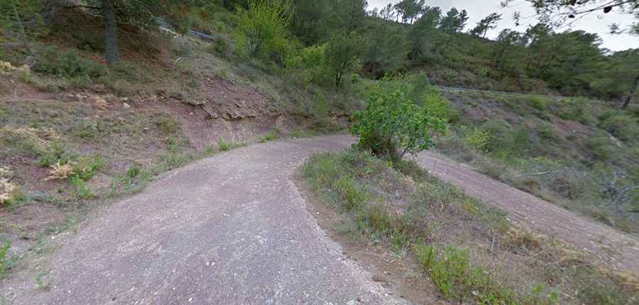
The surface of the Camino de Ibola is a "mixed bag" of terrain. While some of the steepest ramps and tightest turns have been reinforced with old concrete to prevent erosion, most of the road is pure gravel and dirt. As seen on the local tracks, the ground is often covered in loose red stones and deep ruts. A high-clearance vehicle is highly recommended; a standard sedan will likely scrape its undercarriage on the uneven surface or lose traction on the dusty sections where the concrete ends and the raw mountain begins.
What are the hazards when driving to Pic d'Espadà?
The biggest threat on the way to the summit is the weather and the terrain's instability. After heavy rains, which are common in the fall in Castellón, the road often becomes impassable due to mud and rockfalls. The track is narrow, and in many places, there are no guardrails between you and the steep drops into the ravines. Visibility is also an issue; the thick pine trees and the constant curves mean you are driving blind for much of the ascent. If you're not comfortable with reverse maneuvers on a cliff edge, this road will test your limits.
Is the drive to Pic d'Espadà worth the effort?
For those who want to escape the crowded coastal roads, the Pic d'Espadà is a masterclass in isolation. From the highest points of the Camino de Ibola, you can see all the way to the Mediterranean on clear days. It’s a quiet, demanding route that feels a world away from the nearby beaches. There are no gas stations and no services, so ensure your tank is full before leaving Aín. In the Serra d'Espadà, the mountain rewards those who take it slow and respect the rough surface. Take your time, watch the ruts, and focus on the road.
Driving in the province of Castellón is always an adventure if you stay off the main highways. The road to Pic d'Espadà is a raw, unpolished experience that shows you the true backbone of the Valencian mountains. Check your tires, keep your lights on for visibility in the forest shadows, and stay sharp. The mountain doesn't care about your schedule, so enjoy the slow grind to the top.