How to drive the unpaved road to Cerro El Buitre in Almeria?
Cerro El Buitre is a high mountain peak at an elevation of 2.466m (8,090ft) above sea level located in Almería province, in Spain. It’s one of the highest roads of the country.
Where is Cerro El Buitre?
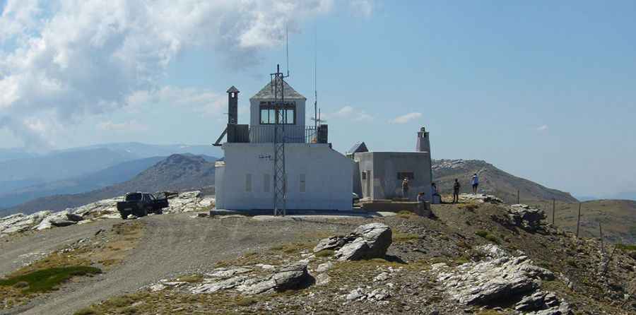
The peak is located in the autonomous community of Andalusia, in the southern part of the country, within the Sierra Nevada National Park. At the summit there are a couple of constructions for fire detection.
Is the road to Cerro El Buitre unpaved?
The road to the summit is totally unpaved and challenging, with narrow parts, steep sections and many curves, with 21 hairpin turns. A 4x4 vehicle is required.
How long is the road to Cerro El Buitre?
Starting from Ohanes, the road to the summit is 20.9 km long. Over this distance, the elevation gain is 1399 m and the average gradient is 6.69%.
Is the road to Cerro El Buitre open year-round?
Set high in the Sierra Nevada mountain range, the road can be blocked anytime due to the heavy snowfalls in the area.
Pic&more info: http://www.altacota.com/beticoAlmerienseBuitreVistas.html