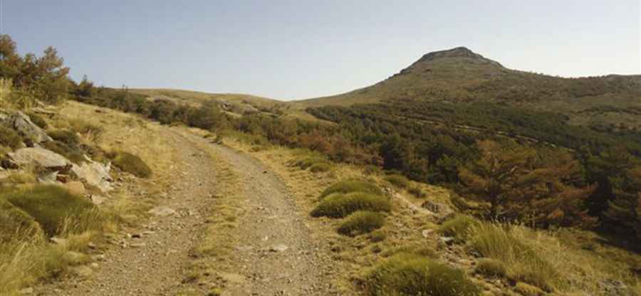
Cerro Almirez: The brutal 31-hairpin 4x4 track in Almería
Cerro Almirez is a massive mountain summit at an elevation of 2,350 meters (7,709 ft) above sea level, located in the Almería sector of the Sierra Nevada National Park. The road to the summit is a raw forest track carved into crumbling slate and shale, standing as one of the highest roads in Spain. The physical reality of driving this route involves managing 31 sharp hairpin turns on a narrow, unpaved ledge where the low-range gearing of a 4x4 is mandatory to handle the vertical gain and the lack of oxygen at the summit.
| Road facts: Cerro Almirez | |
|---|---|
| Location | Almería, Andalusia, Spain |
| Elevation | 2,350m (7,709ft) |
| Length | 23.2 km (14.4 miles) |
| Hairpin Turns | 31 switchbacks |
How challenging is the 23km climb to Cerro Almirez?
The journey starting from Paterna del Río is a long-distance mechanical torture test. Over 23.2 kilometers, the track scales the eastern Sierra Nevada massif through 31 hairpin turns. The surface is composed of loose slate and shale that can make the steering feel light and unpredictable. The logistics of the drive require a slow-speed crawl in low gears for several hours; the engine's cooling system will be pushed to its thermal limits because the slow forward movement provides very little airflow to the radiator while the motor fights the steep incline and the thin air above 2,000 meters.
What are the hazards on the unpaved track to the summit?
The primary hazard on Cerro Almirez is the combination of unstable ground and extreme isolation. The track is exceptionally narrow, often with deep drops and no safety barriers. The physical reality of the Almería slate is that it crumbles easily, making the edges of the road treacherous. Meeting another vehicle on the 31 hairpins is a logistical nightmare; one driver will have to reverse on a steep, slippery incline to find a spot wide enough to pass. If you suffer a mechanical failure here, cell service is non-existent and you are hours away from any professional assistance back in the valley.
Is the road to Cerro Almirez open during the winter?
Accessibility is strictly seasonal. From October to June, the road is usually blocked by deep snow and ice, turning the narrow track into a lethal trap. Even in summer, sudden mountain storms can wash out entire sections of the track, carving deep ruts that can ground a standard 4x4. The temperature at 2,350 meters drops significantly even in August; if you get stuck or forced to spend the night due to a breakdown, you need to be prepared for near-freezing conditions. The logistics of the descent are critical; relying only on the brakes for 23 kilometers will boil the fluid instantly. You must use engine braking to hold the vehicle back.
What mechanical prep is needed for the 2,350m Almería climb?
Before leaving Paterna del Río, verify that your cooling fan and radiator levels are perfect. Check your tire sidewalls for any cuts; the sharp shale of the Almirez track is notorious for slicing through rubber. Your brakes must be in top condition, but your driving technique is more important: do not ride the pedal on the 31 hairpins. Carry at least 20 liters of extra water, a full-sized spare wheel, and professional recovery gear like a kinetic rope. In this remote part of the eastern Sierra Nevada, your vehicle's mechanical integrity is the only thing standing between you and the harsh reality of the high-altitude world.
Pic: http://www.juntadeandalucia.es/medioambiente/servtc5/ventana/paginas/transnevada/etapaCuatroVeranoTransnevada.jsp