Driving the road to Tetica de Bacares is not a piece of cake
Tetica de Bacares is a high mountain peak at an elevation of 2.050m (6,725ft) above sea level, located in the province of Almería in Spain.
Where is Tetica de Bacares?
The peak is located in the eastern part of the autonomous community of Andalusia, in southern Spain.
Why is there a road to Tetica de Bacares?
The summit hosts many communication towers. From the top you get great views across various mountain ranges of Almeria. On a clear day you can see both the Tabernas Desert and the Sierra Nevada National Park.
How challenging is the road to Tetica de Bacares?
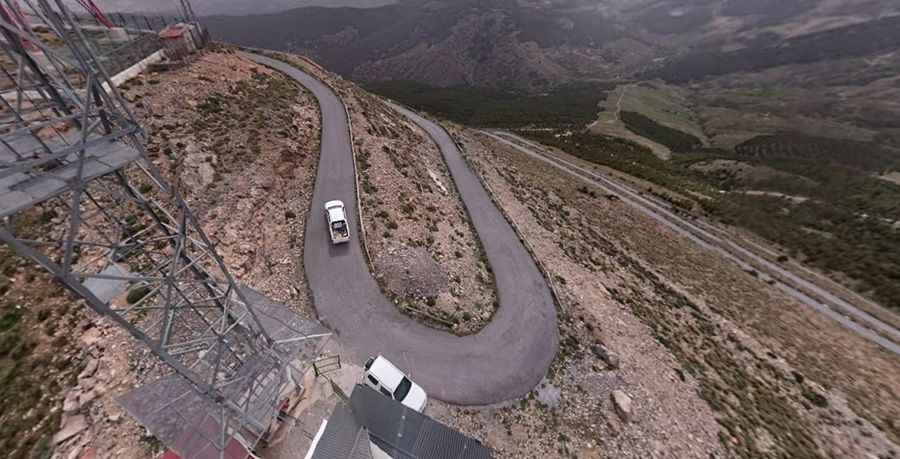
The road to the summit is mostly asphalted, but very steep and narrow, with 5 sharp hairpin turns. The final kilometre is especially challenging, with gradients between 14-17% on a corrugated concrete surface.
How long is the road to Tetica de Bacares?
Starting from the paved AL-3102 Road, near Alto de Velefique, the road to the summit is 3.3 km long. Over this distance, the elevation gain is 224 m and the average gradient is 6.78%.
Is the road to Tetica de Bacares open in winters?
Set high within the Sierra de Filabres mountain range, in the Penibética Mountain Range, the road is usually open throughout the year.
Pic: José Hernández