Driving the unpaved track to Pico Zapatero in Avila
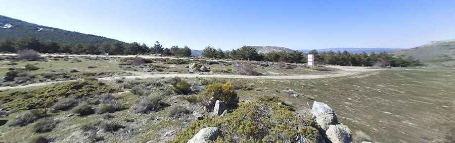
Pico Zapatero, also known as Cuchillar del Zapatero, is a high mountain peak at an elevation of 1,914 meters (6,279 ft) above sea level, located in the Ávila province of Castile and León, Spain. Situated in the Sierra de la Paramera, the long unpaved track climbs to the telecommunication antennas built at the summit ridge.
| Road facts: Pico Zapatero | |
|---|---|
| Location | Ávila, Castile and León (Spain) |
| Elevation | 1,914 m (6,279 ft) |
| Length from AV-900 | 22.9 km (14.2 miles) |
| Elevation Gain | 729 meters |
| Average Gradient | 3.18% |
| Surface | Unpaved (Dirt and coarse granite stones) |
How challenging is the dirt track to Pico Zapatero?
The long ascent to the summit starts from the paved AV-900 road, north of the Puerto de Navalmoral. The 22.9 km mountain track gains 729 vertical meters over a rough surface consisting of dirt, embedded granite slabs, and loose scree. While the average gradient is a low 3.18%, the track features continuous erosion ruts and deep mud holes that require high ground clearance and 4x4 traction to avoid hitting the vehicle underbody.
What are the driving hazards on the Pico Zapatero mountain track?
The route crosses several cattle grids and metal gates used for livestock management in the high pastures. The track runs along open, unprotected ridges where strong crosswinds and sudden mountain fog reduce visibility to a few meters. The surface is covered with sharp granite stones that can easily cut tire sidewalls, and the lack of lateral space or turnarounds makes reversing compulsory if encountering oncoming maintenance trucks.
Is the road to Pico Zapatero open in winter?
Due to the 1,914-meter altitude of the Sierra de la Paramera, the track is regularly blocked by deep snowdrifts and sheet ice from November to April. The trail receives no winter maintenance or clearing, turning the upper sections into a complete dead end. The optimal period to drive the ridge track is during the dry summer months, though heavy winter storm runoff leaves deep gravel ruts along the final steep ramps to the antennas.
Pic: Lorenzo Gallardo