How to drive the unpaved road to Pico del Chullo in Andalusia
Pico del Chullo is a high mountain peak at an elevation of 2.520m (8,267ft) above sea level, located in Andalusia, in Spain. It's one of the highest roads in the country.
Where is Pico del Chullo?
The peak is located on the border of Granada and Almeria, in the southern part of the country, within the Sierra Nevada National Park.
What’s at the summit of Pico del Chullo?
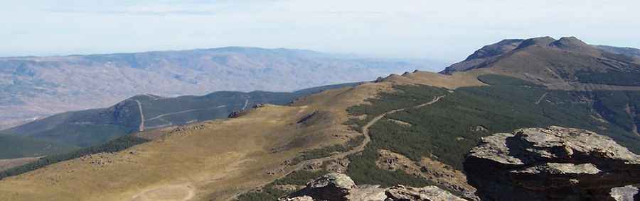
At the summit there’s a mountain hut known as Refugio de la Minilla o del Chullo. The shelter is very basic, only to be used in case of urgent need. The summit is famous due to its views: to one side, the peaks of Mulhacén and Veleta; to the other, the Marquesado de Zenete and, on the clearest days, the distant Mediterranean Sea.
Is the road to Pico del Chullo unpaved?
The road to the summit is totally unpaved, with loose gravel and rocks. It’s more a mule path than a road. A 4x4 vehicle with high clearance is required.
How long is the road to Pico del Chullo?
Starting from Puerto de La Ragua, the ascent is 3.6km long. Over this distance the elevation gain is 476 meters with an average gradient of 13.2%, but with sections up to 20%.
Is the road to Pico del Chullo open year-round?
Set high in the Sierra Nevada mountains, the road can be blocked anytime due to snow and ice. It’s usually impassable from November to March. Expect cold and high winds.
Pic: cesar abru