Coll d'Ares: The steep and degraded road in the Montsec d'Ares
Coll d'Ares is a high mountain pass at an elevation of 1,536 meters (5,039 ft) above sea level, located in the Serra del Montsec, within the La Noguera comarca in Catalonia, in Spain. The narrow road to the pass climbs the raw limestone walls of the Montsec d'Ares, starting from the valley floor near Àger.
| Road facts: Coll d'Ares (Montsec) | |
|---|---|
| Location | Lleida, Catalonia (Spain) |
| Elevation | 1,536 m (5,039 ft) |
| Length | 13.9 km from Àger |
| Elevation Gain | 924 meters |
| Max Gradient | 11% |
How challenging is the climb out of Àger to Coll d'Ares?
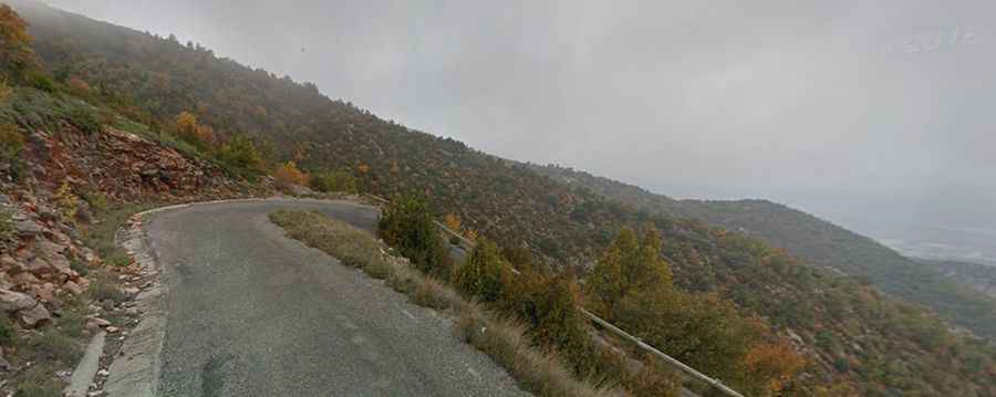
The 13.9 km ascent from Àger clears 924 vertical meters over a narrow lane featuring 12 tight hairpin turns. The asphalt is severely degraded, cracked, and covered in loose stone debris that cuts tire traction on the 11% ramps. The steepness forces a slow, low-gear crawl from the valley floor up to the high mountain pass.
What are the main hazards on the Montsec d'Ares road?
The primary perils are the deep potholes, broken pavement margins, and the complete lack of safety barriers along the drop-offs. The road experiences regular traffic from paragliding shuttle vans that frequently cut corners on blind bends, forcing oncoming cars toward the loose edges. On the descent back to the C-12, driving in short gears and using the engine to slow down is required to prevent the frens from overheating and losing power completely.
What is the road condition to Sant Alís summit?
Beyond the asphalt terminal at Coll d'Ares, an unpaved mountain track continues toward the highest crest at Sant Alís, reaching 1,675 meters above sea level. This final section transitions into a rough path made of loose rocky limestone and dirt slabs, where deep erosion ruts and sharp stones require high ground clearance to avoid hitting the car's underbody. Heavy winter snowdrifts completely block this exposed ridge track until the late spring thaw.