How to drive the steep road to Alto El Rey in Guadalajara
Alto El Rey is a high mountain peak at an elevation of 1.858m (6,095ft) above sea level, located in the province of Guadalajara, in Spain.
Where is Alto El Rey?
The peak, also known as Montaña Sagrada del Santo Alto Rey, is located in the autonomous community of Castile-La Mancha, in the central part of Spain.
What’s at the summit of Alto El Rey?
At the summit there’s a small chapel known as Ermita del Alto Rey. From this position, it’s possible to see three provinces. There is limited parking right at the viewpoint, but it's usually not very crowded.
How long is Alto El Rey?
Starting from the paved GU-147 road, south of Aldeanueva de Atienza, the road to the summit is 4.7 km long. Over this distance, the elevation gain is 399 m and the average gradient is 8.48%. The road features gradients of 14%.
Is the road to Alto El Rey paved?
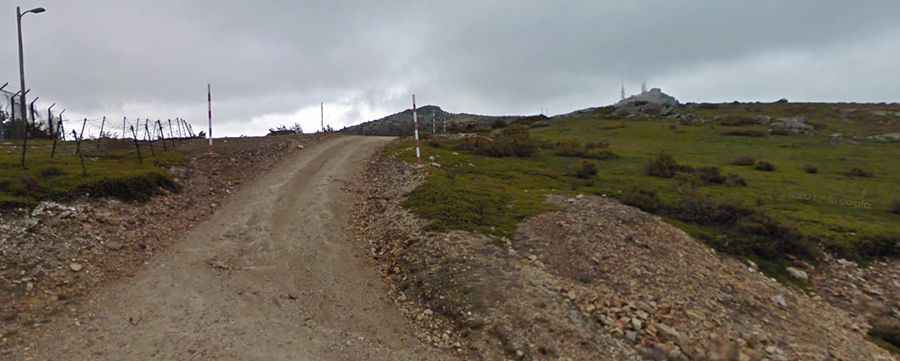
The road comprises paved and unpaved parts. The first 3.7km are totally paved. The road is generally good, though a bit narrow. The last kilometer, beyond an abandoned military base with some communications tower, known as CT1 Centro de Transmisiones del Ejército, is totally unpaved in very poor condition; the car skids quite a bit due to the lack of traction. A 4x4 vehicle is recommended.
Is the road to Alto El Rey open in winter?
Set high in the Sierra de Ayllón of the Sistema Central range, the road is usually open year-round, but short-time closures are common in winters.