An otherworldly road to Peña de Francia in Salamanca
Peña de Francia is a high mountain peak at an elevation of 1.708m (5,603ft) above sea level, located in the province of Salamanca, in Spain.
Where is Peña de Francia?
The peak is located in the Autonomous Region of Castile and León, to the south of the city of Salamanca, in the western part of the country. The summit hosts a sanctuary, called Nuestra Señora de la Peña de Francia, and some communication facilities.
Is the road to Peña de Francia open in winter?
Set high in the Sierra de Francia mountain range, the summit is virtually inaccessible in the winter due to large amounts of snow.
Is the road to Peña de Francia paved?
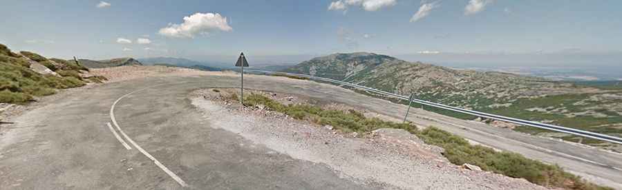
The road to the summit is paved but in very poor condition, with potholes and gravel sections. It’s narrow and pretty steep, with sections up to 9.2% and 5 hairpin turns. It's called SA-203.
How long is the road to Peña de Francia?
Starting from Paso de los Lobos, a mountain pass at 1.500m (4,921ft) above sea level, the road to the summit is 3.6 km (2.23 miles) long. Over this distance, the elevation gain is 203 m. The average gradient is 5.63%.