The brutally steep road to Monte Oiz in the Basque Country
Monte Oiz is a mountain peak at an elevation of 1,026 m (3,366 ft) above sea level, located in the autonomous community of Basque Country, Spain. The climb is simply terrible, hitting 20% gradients. The climb is known for its half-asphalt, half-concrete surface and irregular ramps.
Where is Monte Oiz?
The peak is located in the province of Biscay, in the northern part of the country. The summit is also known as Balcón de Vizcaya (Biscay Balcony) with views over the Cantabric Sea. Expect fog and rain often.
Why is Monte Oiz famous?
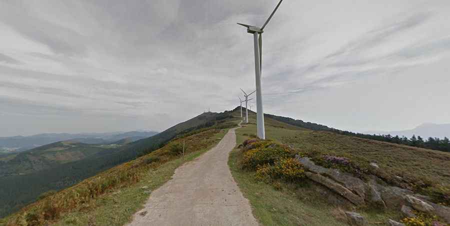
The mountain is clearly distinguished from its surroundings, mostly because of the large antenna and the wind turbines at the top. Its location in the middle of the province and its height provide great views from the summit, from the nearby sea to the surrounding mountains. In 1985, it was the scene of a plane crash, after a flight from Madrid to Bilbao hit the radar tower at the top of the climb in thick cloud.
How long is the road to Monte Oiz?
Starting from Munitibar-Arbatzegi-Gerrikaitz, the ascent is 8.6 km (5.34 miles) long and the average gradient is 9.4%.
Is Monte Oiz paved?
The road surface is in very good condition for the first 6 km. After this, it becomes a narrow corrugated concrete track, slightly bumpy in places. Getting closer to the summit, the road conditions worsen and the slopes that loom become ever more ominous.
How steep is Monte Oiz?
The peak has been featured in the Spanish Vuelta race. The climb is simply brutal, especially the last 5 km with an average gradient of 11% and some sections up to 20%.