Alto de Trobaniello: The brutal 17km unpaved climb in Asturias
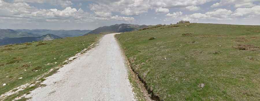
Alto de Trobaniello is a mountain pass at an elevation of 1,625 meters (5,331 ft) above sea level, located in the Las Ubiñas-La Mesa Natural Park in Asturias, Spain. Known locally as the Pista de Ricabo al Alto de Ventana, the 17-kilometer route connects Santa Marina in the Quirós valley with the summit ridge leading toward Puerto de Ventana.
| Road facts: Alto de Trobaniello | |
|---|---|
| Location | Asturias, Spain |
| Elevation | 1,625 m (5,331 ft) |
| Length | 17 km (10.5 miles) from Santa Marina |
| Elevation Gain | 1,040 m (3,412 ft) |
| Max Gradient | 15% |
| Surface | Partially paved, dirt, gravel, and concrete switchbacks |
Where is the road to Alto de Trobaniello located?
The road is located in southern Asturias within the Cantabrian Mountains. The track starts near Santa Marina in the municipality of Quirós and climbs through Ricabo before continuing along the unpaved forest track toward the summit at 1,625 meters.
How steep is the climb to Alto de Trobaniello?
Starting from Santa Marina, the climb spans 17 kilometers with over 1,000 meters of elevation gain. The initial 6 kilometers run on narrow asphalt with an average gradient of 4.8%. The final 11 kilometers transition to an unpaved surface consisting of gravel, loose stones, and concrete-paved hairpin turns. The steepest kilometer, between kilometer 12.5 and 13.5, averages 12.7% with peak ramps reaching 15%.
What hazards exist on the unpaved Pista de Ricabo?
The main hazard is the unpaved gravel surface, where loose stones and water channels reduce wheel traction on the 15% ramps. The track is single-lane width with no safety barriers along exposed mountain drops. Meeting local 4x4s or forestry machinery requires stopping or reversing to narrow passing pockets. On the 17-kilometer descent, drivers must use low gears to engine brake and avoid overheating brake pads.
Is Alto de Trobaniello open in winter?
No. Due to its elevation of 1,625 meters, heavy snow covers the unpaved track during the winter and early spring months. Because the route is a high-altitude mountain forest track, snowplows do not clear the pass, leaving it impassable until the seasonal spring thaw.