A Narrow Paved Road to Puerto de la Ragua, Offering Stunning Views of Andalusia
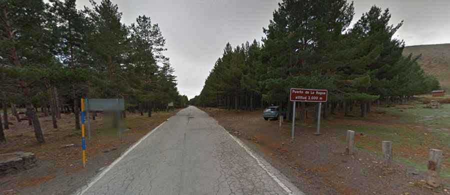
Puerto de la Ragua is a high mountain pass at an elevation of 2.046m (6,712ft) above sea level, located in the autonomous community of Andalusia, in Spain.
Where is Puerto de la Ragua?
Puerto de la Ragua is on the boundary between Granada and Almería provinces, in the southern part of Spain.
How long is Puerto de la Ragua?
Set high in the Sierra Nevada (the same mountain range where Pico Veleta is located), the pass is 29.1 km (18.08 miles) long, running from La Calahorra to Laroles along the A-337 road, which is paved but in poor condition.
Is Puerto de la Ragua Open Year-Round?
Tucked away in the Sierra Nevada National Park, the pass is usually accessible throughout the year, but winter weather can cause occasional closures or restrictions.
Is Puerto de la Ragua Challenging?
The road has steep sections with a maximum gradient of 9.1%. It's narrow, often less than five meters wide, with numerous turns and steep drop-offs, many without safety barriers. The north face can be especially hazardous in winter. The road has low traffic, averaging 200 vehicles daily.
Is a Drive through Puerto de la Ragua Worth It?
Yes, the route offers stunning panoramic views. At Puerto de la Ragua, you can enjoy a variety of sports activities and take short walks to places like "Morrón del Hornillo" or "Chullo" for spectacular vistas. The northern views include the plain of Marquesado, Sierra de Baza, the Filabres, and the Sierra de Cazorla. To the south, you can see the Sierra de Gador, Contraviesa, the Mediterranean Sea, and on clear days, even Africa. There is a big parking lot at the summit and leisure facilities, including a recreational and cross-country ski station.