Driving to Mont Caro, the Highest Road in Tarragona — Only if You’re Not Afraid of Heights
Mont Caro is a mountain peak at an elevation of 1,447m (4,747ft) above sea level, located in Catalonia, Spain. The summit is heavily built up, partly occupied by large buildings and towering antenna masts. The road to the top is narrow and dangerous, particularly during winter.
Where is Mont Caro?
Mont Caro is situated in the province of Tarragona, in northeastern Spain, within the Els Ports Natural Park.
Why is Mont Caro Famous?
At this elevation, Mont Caro is the highest point in both the Ports de Tortosa-Beseit range and the province of Tarragona. The summit features two large antennas and a shrine to the Virgin Mary, offering a 360-degree view that, on clear days, allows you to see the Ebro Delta and even the Balearic Islands.
| Road facts: Mont Caro | |
|---|---|
| Location | Tarragona, Catalonia (Spain) |
| Elevation | 1,447 m (4,747 ft) |
| Length | 23.2 km (14.4 miles) |
| Max Gradient | 20% |
| Surface | Paved (Narrow) |
What’s the Weather Like on Mont Caro?
Located in the Ports de Tortosa-Beseit range, Mont Caro experiences a Mediterranean climate. In summer, the forest can become extremely hot and dry. Be sure to stop along the way to enjoy the stunning views and the birdlife in the various habitats. During winter, snowfalls occasionally cover the summit, making the final sections extremely slippery.
How Challenging is the Road to Mont Caro?
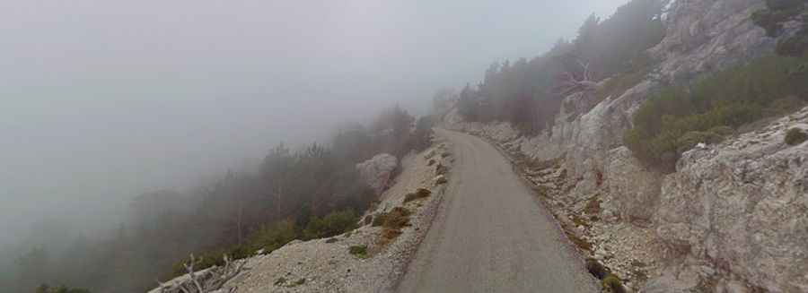
The road to the summit is fully paved. While some sections have been improved recently, it remains a steep and technical drive. The road is narrow, lacks central markings, and is barely wide enough for two cars to pass, with no guardrails in several exposed areas. The climb is long and tough; as you ascend, the road becomes more worn with rocky roadside edges. The ascent bears some resemblance to Mont Faron in France. While Mont Faron is short and steep, Mont Caro’s climb is long and exhausting, though both offer stunning views of the coastline below.
How Long is the Road to Mont Caro?
Beginning in Tortosa, the ascent stretches for 23.2km (14.41 miles) with a massive elevation gain of 1,424 meters. The average gradient is 6.1%, but the road becomes very steep near Lo Portet, with sections reaching up to 20%. This legendary climb has also been a featured stage in the Volta a Catalunya cycling race, cementing its status as the "Mont Ventoux" of Catalonia.