Driving the wild road to Port de Cabus in the Pyrenees
Port de Cabús is an international high mountain pass at an elevation of 2,308 meters (7,572 feet) above sea level, located on the Andorran-Spanish border. It's one of the highest roads in the country.
Where is Port de Cabús?
The pass, also known as Coll de Cabús, links the Pallars Sobirà comarca in the Province of Lleida in the western part of the autonomous community of Catalonia, in northeastern Spain, with La Massana, one of the seven parishes of the Principality of Andorra in the northwest of the country.
Why is Port de Cabús famous?
At the summit, there is a large parking lot and The Storm, a teacup sculpture by the artist Dennis Oppenheim. There are no border controls at the pass. Historically, it was an important smuggling route into and out of Spain.
Is Port de Cabús open?
Set high in the Pyrenees mountain range, road traffic is prohibited in winter (while there is snow on the tracks). It is recommended to use this route between June and October.
How long is Port de Cabús?
The road to the summit is 25.0 km (15.53 miles) long, running east-west from La Massana (in Andorra) to Tor (in Spain).
Andorran side:
On the Andorran side, the road to the summit is totally paved. It’s called CG4. At this elevation it’s one of the highest paved roads of Europe. The road is 17.8 km (11.06 miles) long starting from La Massana, the main town of the parish. The road to the summit is very steep, hitting an 11.7% of maximum gradient through some of the ramps. The last 2 -3 kilometers of the road whilst paved will have no safety barriers, the cliffs are rocky and the drops are significant. If you have any doubts in your car or your own ability to drive up here then don’t.
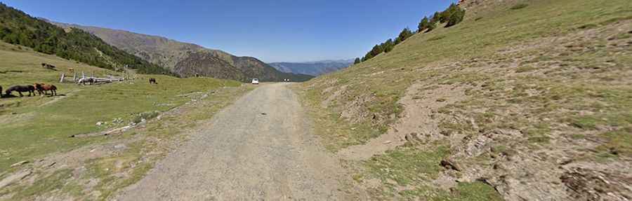
Spanish side:
On the Spanish side, the road is totally unpaved. It’s called Carretera de Tor. It’s a very challenging drive with rough parts. A 4x4 vehicle is recommended. The road is 7.5 km (4.66 miles) via 9 sharp hairpin turns starting at Tor. During and after a storm the road may be impassable, even with a four-wheel-drive vehicle. The road to the summit is very steep, hitting a 12% of maximum gradient through some of the ramps. Road traffic is strictly regulated within this natural setting and no unauthorized convoys of more than 4 vehicles are permitted.