Estany Llong: Driving the restricted 4x4 track in Aigüestortes
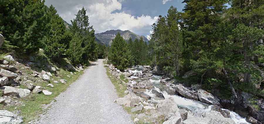
Estany Llong is a high-altitude glacial lake situated at 2,012m (6,601ft) above sea level in the province of Lleida, Catalonia. Located in the heart of the Aigüestortes i Estany de Sant Maurici National Park, the road to the lake is a highly technical mountain track. Unlike standard Pyrenean passes, this route is a restricted service road where the combination of steep concrete sections and broken gravel creates a demanding environment for high-clearance 4x4 vehicles.
| Road facts: Estany Llong | |
|---|---|
| Location | Aigüestortes National Park, Lleida (Spain) |
| Max Elevation | 2,012m (6,601ft) |
| Length | 11.9 km (7.39 miles) |
| Access | Restricted (Official 4x4 taxis only) |
How challenging is the climb from the L-500 to Estany Llong?
The ascent begins at the junction with the L-500 road and covers 11.9 kilometers with an elevation gain of 695 meters. The first 7.7 km consist of a narrow track with several concrete sections designed to provide traction on the steepest ramps. However, the challenge here is the final 4 km stretch, which is completely unpaved and transitions into a rough mountain track. Navigating this section requires managing deep ruts and loose stones, especially as the road gains altitude toward the Estany de Llebreta. The average gradient is 5.84%, but the constant need to make room for oncoming official 4x4 vehicles on the narrowest ledges makes the drive a high-concentration task.
Why is the access to Estany Llong restricted to official 4x4s?
Due to its location within one of Spain's most protected National Parks, the road to Estany Llong is strictly closed to private motorized traffic. The only vehicles permitted on this track are the official 4x4 taxis that operate from the village of Boí. These professional drivers navigate the 11.9 km route multiple times a day, dealing with the technical challenges of the Pyrenees weather and the deteriorating surface of the upper track. For any driver authorized to use this road, the main hazard is the lack of passing space; in many sections, one vehicle must reverse to a wider spot on a steep incline to allow the other to pass safely.
What are the technical hazards of the Aigüestortes mountain road?
The road to Estany Llong is defined by its verticality and the unpredictability of the Pyrenean climate. While the concrete ramps prevent the tires from spinning in wet conditions, they can become extremely slick when covered in ice or mud washed down from the slopes. The final unpaved kilometers toward the 2,012m refuge are particularly taxing on the vehicle suspension, as the ground is a mix of granite boulders and fine silt. Self-sufficiency and mechanical sympathy are required, as a breakdown in the upper reaches of the park involves complex recovery logistics in a high-protection environmental zone.
How does the Pyrenees weather affect the road to Estany Llong?
At 2,012 meters, the road is subject to rapid weather shifts that can turn a dry track into a water-logged trench in minutes. During the winter and early spring, the road is buried under heavy snow, making it impassable for wheeled vehicles and accessible only by foot or specialized machinery. The presence of the Estany de Llebreta along the route means that the humidity is always high, often resulting in dense fog that reduces visibility on the narrowest parts of the climb. Navigating these sections requires total precision to stay on the main track and avoid the soft edges where the terrain drops off toward the Sant Nicolau river valley.