Pico del Veleta is the highest paved road of Europe
Pico del Veleta is a high mountain peak at an elevation of 3,369m (11,053ft) above sea level, located in the region of Andalusia, Spain. It's one of the highest roads in Europe. At an altitude of around 3,000m, road conditions become significantly worse.
Where is Pico del Veleta?
The pass is situated on the boundary between the provinces of Granada and Almeria, in the southern part of the country. The road to the summit is the highest paved road in Europe.
Can you drive to Pico del Veleta?
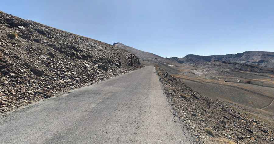
The access road to the summit is 13.3km (8.26 miles) long, starting at the Sierra Nevada ski resort. It is mostly paved, with only the last meters being unpaved. The road was built after the creation of the Sierra Nevada National Park. In 1999, the road was closed to general traffic beyond Hoya de la Mora, just above the ski station. However, the road is still used by ski station employees, national park rangers, cyclists, and walkers. There is also a microbus service that takes hikers up to Posiciones del Veleta, a viewpoint at 3,100 meters above sea level. At 2,600m, a barrier marks the end for public motor traffic. The road conditions up to this barrier are excellent, as the entire route from Granada was newly asphalted in late summer 2007, providing a paradise for road bikers. Beyond the barrier, conditions significantly worsen. Potholes and rock slides do not significantly impede the ascent but pose problems on the downhill ride. At an altitude of around 3,000m, road conditions become significantly worse. The altimeter shows 3,267m when the road conditions no longer allow riding the route with a race bike. Thus, you have to push your bicycle the last 900m. On the last 10m, you even have to shoulder the bike. The road ends at approximately 10 meters below the summit.
Is the road to Pico del Veleta steep?
Starting at the Sierra Nevada ski resort, the elevation gain is 1,232 meters. The average gradient is 9.26%. The first few kilometers are tough with sections at 14%, 15%, and 17%, but the scenery is fantastic, and there is almost no traffic on the road. The last 8 km get harder, though. The final meters are simply brutal, reaching a maximum gradient of 26%. The climb has never featured in the Vuelta España race because it’s simply too long, too high, and too tough for a Grand Tour.
Is the road to Pico del Veleta open?
Set high in the Sierra Nevada mountain range, weather conditions vary greatly between summers and winters. Do not attempt this in summer - it is a challenging climb, and with the heat, it will not be enjoyable. Similar to the Alps, weather conditions can worsen within only a few minutes. Suddenly rain clouds can appear behind the Pico, and temperatures can decrease by more than 20 degrees Celsius, dropping to only a few degrees above freezing. From November until April, there is likely to be some snow near the top, meaning you will probably only be able to get as far as the service road at 2700m (which is a hard enough climb). May, early June, late September, and October are the best months to tackle the climb. There is less traffic, and the top should be free from snow - just remember to take a jacket because you can still get cold on a 40km descent even if it seems nice and warm! It's one of the highest roads in the country.
Pic: David Stolarsky