An old, narrow road full of holes to the top of Los Pelaos in Andalusia
Los Pelaos is a high mountain peak at an elevation of 1,873m (6,145ft) above sea level, located in the Spanish province of Granada. The climb is extremely challenging, with sections reaching gradients of up to 17%. It’s an old, narrow road filled with potholes and features 13 hairpin turns.
Where is Los Pelaos - Repetidor Lújar?
The peak is located in the autonomous community of Andalusia, in the southern part of Spain. At the summit, there are communication facilities. The summit offers breathtaking 360° views of the sea and the Alpujarras.
When was the road to Los Pelaos - Repetidor Lújar built?
Set high in the Alpujarra mountains, in the Sierra de Lújar range, the road to the summit was constructed in the 1960s to access the communication towers, known as Repetidores de Lújar, at the summit.
How long is the road to Los Pelaos - Repetidor Lújar?
The road to the summit is 9.5 km (5.90 miles) long, starting from Puerto Camacho, a mountain pass on the A-4131 Road. Over this distance, the elevation gain is 734 meters, with an average gradient of 7.72%.
Is the road to Los Pelaos - Repetidor Lújar paved?
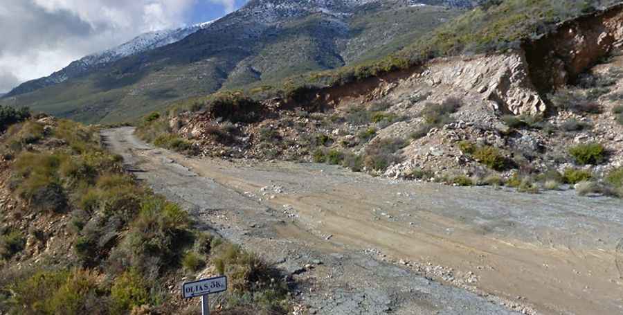
The road is a real challenge, with grass growing through the cracks in the severely deteriorated asphalt, along with large potholes, stones, and a very bumpy surface. This section is practically devoid of traffic and is more of a dirt track than a proper road. Although it is reportedly possible to drive a car on this track, it is highly recommended for mountain biking (MTB). The final section is a narrow road with terrible asphalt and countless potholes, making it a very difficult climb for an ordinary car. The rough road surface, with what little remains of the tarmac, adds even more character to this memorable climb.