How to drive the unpaved road to Roque de la Grieta in Tenerife
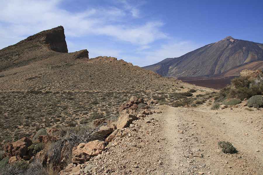
Roque de la Grieta is a high mountain peak at an elevation of 2,417 meters (7,929 ft) above sea level on the island of Tenerife, in the Canary Islands, Spain. Traversed by an unpaved forest track through the Corona Forestal Natural Park, the climb passes across the Llano de los Infantes plateau (2,315 m) near the Teide caldera rim. It's one of the highest roads in Spain.
| Road facts: Roque de la Grieta & Llano de los Infantes | |
|---|---|
| Location | Tenerife, Canary Islands (Spain) |
| Peak Elevation | 2,417 m (7,929 ft) |
| Plateau Elevation | 2,315 m (7,595 ft) - Llano de los Infantes |
| Length | 11.4 km (7.08 miles) from TF-24 |
| Surface | Unpaved (Dirt, volcanic gravel, and washed-out tracks) |
| Vehicle Required | High-clearance 4x4 (Access restricted by gate) |
Where is Roque de la Grieta located?
The track is located in the central mountain region of Tenerife, within Corona Forestal Natural Park. The route starts from the paved TF-24 road and ascends along the high ridges toward the summit.
What are the driving conditions to Llano de los Infantes and Roque de la Grieta?
The 11.4-kilometer trail is entirely unpaved, consisting of loose dirt, volcanic gravel, and steep ramps. Near the start, the track crosses Llano de los Infantes, a high mountain plateau at an elevation of 2,315 meters. Higher up, the single-lane route narrows significantly with steep drop-offs along the slopes.
What hazards exist on the road to Roque de la Grieta?
The upper section of the track is severely washed away by erosion, requiring a high-clearance 4x4 to manage deep ruts and loose rock obstacles. Furthermore, motor vehicle access is restricted and blocked to unauthorized private traffic by a locked gate.
How long is the road to Roque de la Grieta?
Starting from the junction at the paved TF-24 road, the track covers a distance of 11.4 kilometers to reach the 2,417-meter peak.
Pic: rutasdetenerife@hotmail.com