How to drive the unpaved road to Morra del Buitre in Sierra de Castril
Morra del Buitre is a high mountain pass at an elevation of 2,032m (6,666ft) above sea level, located in the province of Granada, in Spain.
Where is Morra del Buitre?
The pass is situated just south of the Peñón del Toro, near the border between the provinces of Granada and Jaén, in the autonomous community of Andalusia, in the southern part of the country. It is one of the highest driveable points in the Sierra de Castril Natural Park.
| Fact | Details |
|---|---|
| Elevation | 2,032m (6,666ft) |
| Distance | 13.6 km from A-4301 |
| Elevation Gain | 918 m |
| Average Gradient | 6.75% |
| Location | Sierra de Castril (Granada), Spain |
| Recommended Vehicle | 4WD with high clearance |
Is the road to Morra del Buitre unpaved?
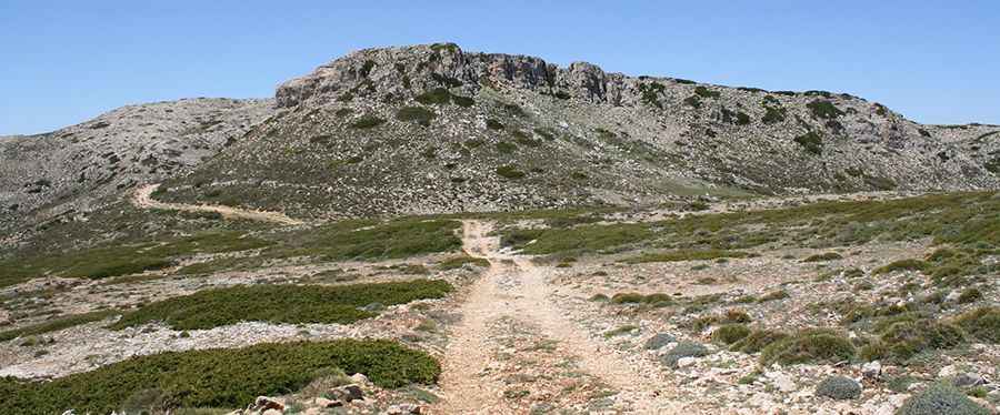
The road is entirely unpaved, with loose limestone rocks and deep ruts, especially after the spring rains. The road is narrow and some parts of the track hug the mountainside with significant exposure. A high-clearance 4x4 vehicle is highly recommended.
How long is the Road to Morra del Buitre?
Starting from the paved A-4301 road, the road to the summit is 13.6 km (8.45 miles) long. Over this distance, the elevation gain is 918 m and the average gradient is 6.75%. Some ramps exceed 12%.
Is the road to Morra del Buitre worth the drive?
As the name "Buitre" (Vulture) suggests, this area is a sanctuary for large raptors. It is common to see Griffon Vultures and the rare Bearded Vulture (Quebrantahuesos). Because it is a protected Natural Park, drivers must stay on the main track and respect local livestock.
When is the best time to drive the road to Morra del Buitre?
Avoid mid-summer due to extreme temperatures and high dust levels. The best windows are late spring (when the peaks might still have patches of snow) and autumn. In winter, snow can block the track above 1,800m for several weeks.
Pic: Acusticalennon