How to drive the curvy road to Coll de Montllobar in Lleida?
Coll de Montllobar is a mountain pass at an elevation of 1.080m (3,543ft) above sea level, located in the comarca of the Pallars Jussà, in Spain.
Where is Coll de Montllobar?
The pass is located in the province of Lleida, in the autonomous community of Catalonia, in the northeastern part of the country.
Is Coll de Montllobar paved?
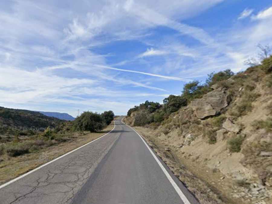
The road to the summit is called C-1311. It is totally paved though not in the best condition, and features countless curves, many of them hairpin turns, narrow sections and steep parts, hitting a 9.3% of maximum gradient through some of the ramps.
How long is the road to Coll de Montllobar?
The road is 25km long, running west-east from Puente de Montañana (in the province of Huesca, Aragon) to Tremp (in the province of Lleida, Catalonia). It has very low traffic.
Is the road to Coll de Montllobar open?
Set high in the Serra de Gurp mountain range, the road is usually open year-round.
Can I drive to Montllobar castle?
South of the summit, a very challenging unpaved road climbs up to Castell de Montllobar, a castle built around 1060. The road is for 4x4 vehicles only due to its surface and steepness. It’s about 1km long.