How to drive the steep road to Pico Mirandiella
Pico Mirandiella is a high mountain peak at an elevation of 1,570m (5,150ft) above sea level, located on the border between Teverga and Somiedo in Asturias. The 1.9 km access track is a steep service road for the communication tower at the summit.
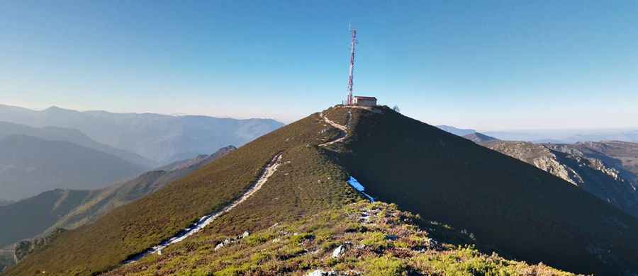
| Road facts: Pico Mirandiella | |
|---|---|
| Location | Somiedo (Asturias), Spain |
| Elevation | 1,570 m (5,150 ft) |
| Length | 1.9 km (1.1 miles) |
| Max Gradient | 15% |
| Surface | Unpaved / Concrete patches |
How long is the road to Pico Mirandiella?
The ascent starts at the summit of Puerto de San Lorenzo (AS-265) and runs for 1.9 km. In this short distance, the track gains 222 meters of vertical elevation. The average gradient is 11.68%, but several ramps hit 15%, forcing the use of low-range gears to maintain traction on the loose surface.
Is the road to Pico Mirandiella unpaved?
The surface is mostly unpaved, consisting of crushed rock and limestone debris. To prevent total loss of grip, some of the 15% ramps have been reinforced with concrete slabs. On the unpaved sections, tires frequently spin due to the lack of compaction. There are no guardrails, and the track is barely wide enough for one 4x4 vehicle, with unstable shoulders that can crumble under heavy weight.
Can I drive to the summit of Pico Mirandiella?
The road is restricted to park rangers, maintenance crews, and local livestock farmers. A high-clearance 4x4 is mandatory to clear the deep ruts and jagged stones that litter the path. Standard vehicles will hit the underbody on the sharp transitions between the dirt and the concrete sections. The track is dead-end and ends at the communication tower.
Is the Pico Mirandiella road open in winter?
At 1,570m, the Sierra La Verde is blocked by deep snow from December to April. The lack of maintenance means rockfalls often block the narrow path after the spring melt. During the rainy season, the limestone dust turns into a slick slurry, making the 15% descent extremely hazardous for braking systems.