Monte Bartolo: Driving to the Highest Peak of Desert de les Palmes
Located in the province of Castelló, on the Costa del Azahar (Valencian Community), the road to Monte Bartolo offers one of the most breathtaking balconies in eastern Spain. Reaching the summit at 729m (2,391ft), the route provides a 360-degree view that stretches from the rugged inland mountains to the Mediterranean horizon.
Where is the road to Monte Bartolo?
The road is located in the northeastern part of the country, within the Desert de les Palmes Natural Park. The ascent starts from the CV-147 road, near the Monastery of Desert de les Palmes, just a few kilometers from the coastal town of Benicàssim.
Why is it called Monte Bartolo?
Also known as Monte San Miguel, the peak is officially named El Pic de la Creu del Bartolo. It owes its popular name to Father Bartolomé (known as "Bartolo"), a Carmelite hermit who sought absolute solitude in a nearby cave during the 17th century. His legendary presence on the mountain eventually led to the peak being named after him.
When was the cross at the summit of Monte Bartolo built?
A monumental cross was first erected at the summit in 1902 to commemorate the turn of the century. Although it was destroyed during the Spanish Civil War, it was rebuilt shortly afterward and remains a landmark visible from miles away.
Next to the communication towers and antennas, you will find the Hermitage of Saint Michael. Built directly on the summit rock, this small, cubic masonry chapel features a colorful ceramic panel of the Archangel Michael above the door. Despite its sober interior and current state of neglect, it remains a site of local pilgrimage every October.
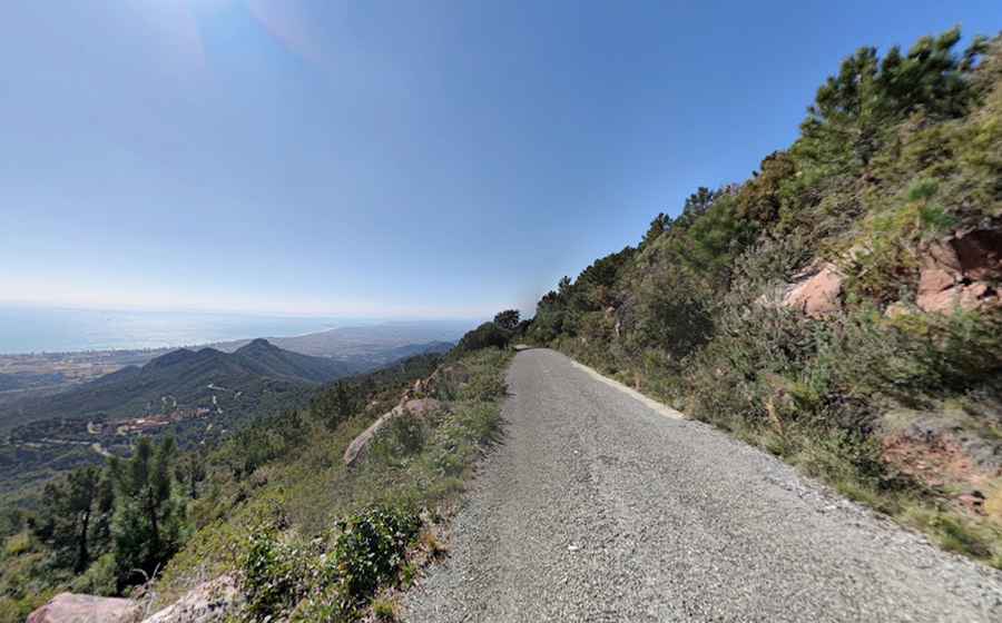
How long is the road to Monte Bartolo?
The final ascent from the CV-147 junction is approximately 3.5 km (2.2 miles) long. While the distance is short, it is a relentless climb with a significant elevation gain. The road is very lonely, with almost no traffic, allowing for a quiet but demanding drive. Its technical difficulty and steepness earned it a spot on the international cycling stage, as it was included in the 2026 Vuelta a España, testing the world's best climbers on its narrow ramps.
What is the driving experience like on Monte Bartolo?
This is a high-intensity driving experience due to the extreme narrowness and technical nature of the track.
- The Gradient: It is a brutal climb. While the average gradient is high, the steepest ramps reach a staggering 17.2%.
- Road Conditions: The road surface is in poor condition, especially during the final ramps. It is a mix of old, rough asphalt and several concrete sections designed to provide traction on the steepest inclines.
- Exposure: The road lacks guardrails and is barely wide enough for a single vehicle. On clear days, the reward is a view of the Columbretes Islands and even the island of Eivissa (Ibiza) on the horizon.
Is the road to Monte Bartolo open to cars?
While technically paved, access for private motor vehicles is frequently restricted to protect the Natural Park. Travelers should check local regulations at the start of the climb, as the final 2 km are often closed to unauthorized traffic, making it a popular challenge for local cyclists and hikers.
Pic: Tino Doménech