How to Get to Creu del Codo by Car in Lleida?
Reaching an elevation of 1,508m (4,947ft) above sea level, Creu del Codó is a mountain peak located in the Solsonès comarca of Lleida, Catalonia. The summit is home to a strategic viewpoint overlooking the Vall de Lord, providing a full perspective of the Sant Llorenç de Morunys area and the La Llosa del Cavall reservoir.
| Road facts: Creu del Codó | |
|---|---|
| Location | Solsonès, Lleida, Spain |
| Elevation | 1,508 m (4,947 ft) |
| Length | 1.5 km (0.93 miles) |
| Surface | Mostly Paved (Narrow) |
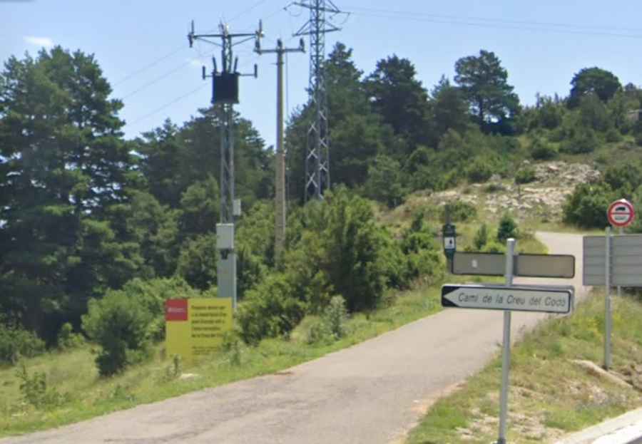
| Access Road | LV-4241 |
How is the access road to Creu del Codó?
The drive follows the Camí de la Creu del Codó, starting from the LV-4241 paved road. The route is only 1.5 km (0.93 miles) long, but it is extremely narrow and technical. The asphalt is aged, and the width of the road is insufficient for two medium-sized vehicles to pass simultaneously. Drivers must use the few available turnouts to allow oncoming traffic to pass. Due to these dimensions, heavy vehicles, motorhomes, and large vans are strictly prohibited from using this track.
Parking and vehicle restrictions
The drivable section for private vehicles ends at a designated parking area. From this point, the final stretch to the actual summit and the Mirador de la Creu del Codó is permanently closed to private motorized traffic. To reach the viewpoint, you must continue on foot for approximately 15 to 20 minutes. This measure is in place to protect the forest environment and prevent congestion on the narrow peak, which lacks a proper turnaround area for multiple cars.
What are the driving hazards in the Vall de Lord area?
The primary hazard is the lack of lateral clearance. The road is carved into the hillside with steep banks on one side and drops on the other, often without safety barriers. During the winter months, the shaded sections of the Camí de la Creu del Codó frequently develop black ice, as the sun does not reach the asphalt. In autumn, wet pine needles can make the surface significantly slippery. Always check for local forestry work, as maintenance trucks occasionally use the route and have absolute priority.
Logistics and Planning
Before heading up, ensure your vehicle is suitable for high-gradient, narrow paths. There are no services, fuel stations, or water at the parking area or the summit; all supplies must be obtained in Sant Llorenç de Morunys. While mobile coverage is generally reliable in the Solsonès area, GPS can sometimes be imprecise on these secondary forest tracks. It is recommended to visit during daylight hours to safely navigate the tightest corners and the irregular pavement.