Is the road to Collada de Cármenes in León difficult to drive?
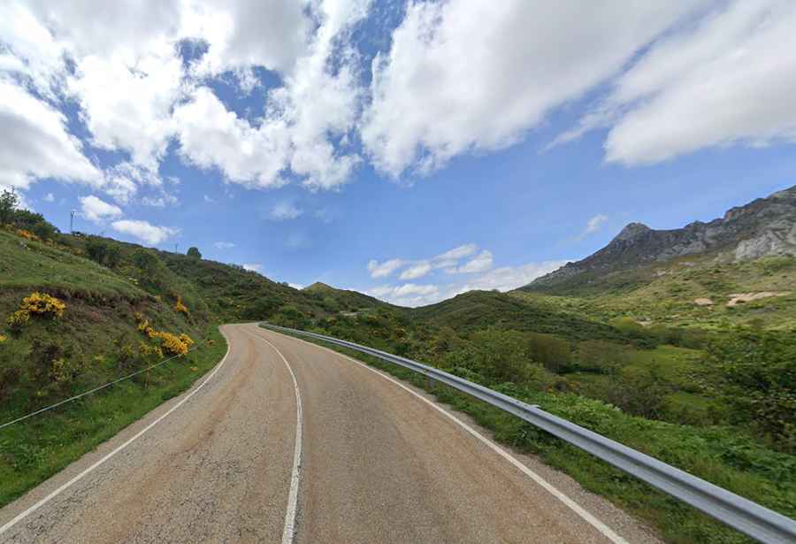
Collada de Cármenes is a mountain pass reaching an elevation of 1,343m (4,406ft) above sea level in the province of León, Spain. Located in the heart of the Cantabrian Mountains, the pass serves as a transition between the valleys of Cármenes and Villamanín. While the main road is a smooth ribbon of asphalt, the real challenge for drivers lies at the summit, where a primitive and narrow 4x4 track breaks away toward the high-altitude ruins of an ancient copper mine.
| Road facts: Collada de Cármenes | |
|---|---|
| Location | Province of León, Castile and León (Spain) |
| Elevation | 1,343 m (4,406 ft) |
| Road Name | LE-312 |
| Length | 8.5 km (5.28 miles) |
| Max Gradient | 10% |
How long is the LE-312 road over Collada de Cármenes?
The paved route spans 8.5 km (5.28 miles), connecting the village of Cármenes in the east with Villamanín in the west. The LE-312 is a well-maintained road with an average gradient of around 5-6%, though some ramps hit a steeper 10% near the top. Despite the good condition of the asphalt, the road is winding and narrow in sections, requiring focus to manage the steady flow of curves. In winter, the 1,343m summit is frequently hit by heavy snow and ice, turning this regional pass into a slick and dangerous stretch where snow chains are often mandatory to avoid sliding off the unprotected embankments.
What is the 4x4 track from Collada de Cármenes to Mina La Profunda?
The real reason for off-roaders to visit Collada de Cármenes is the minor gravel road that starts exactly at the summit parking lot. This unpaved track heads north through the Canal de la Foz de Cepos, leading toward the abandoned Mina La Profunda. Unlike the smooth LE-312, this is a rugged 4x4-only route characterized by loose scree, sharp limestone rocks, and steep gradients. Navigating this trail requires a high-clearance vehicle with low-range gearing, as the path to the old copper mine is often washed out by mountain runoff and receives zero maintenance, making it a treacherous climb even in dry summer conditions.
Why is winter driving hazardous on Collada de Cármenes?
At 1,343 meters, Collada de Cármenes is exposed to the full force of the Cantabrian weather. While the road is a key link for locals, the 10% gradients become lethal sheets of black ice during the cold months. The "burle" winds can sweep snow across the asphalt, creating deep drifts that hide the edges of the road. If you are driving the LE-312 between November and March, you must be prepared for sub-zero temperatures and sudden visibility drops. The descent back toward Villamanín is particularly tricky; even with good tires, the weight of your vehicle on the slippery 10% slopes will force you to use heavy engine braking to avoid losing control on the tightest corners.
Are there any safety risks on the road to Mina La Profunda?
If you decide to leave the asphalt of Collada de Cármenes to explore the mine, you are entering a zone of high mechanical risk. The 4x4 track is narrow and has no safety barriers, with the limestone terrain prone to sudden rockfalls. The main hazard is the loose surface; on the steeper sections of the Foz de Cepos, tires can easily lose grip, sending stones down the hillside. There is no cell service once you descend into the folds of the mountain toward the mine ruins, so self-sufficiency is vital. You must carry a full recovery kit and be aware that a simple mechanical failure on this primitive track can lead to a very difficult and expensive extraction from one of León's most isolated mining sectors.