Things to Know Before Driving the Wild Road to Monte Jaizkibel
Monte Jaizkibel is a coastal mountain peak at an elevation of 532 meters (1,745 ft) above sea level, located in the Gipuzkoa province of the Basque Country, Spain. Situated near the French border, it stands as the second-highest coastal mountain in the country and is traversed by the scenic GI-3440 road.
| Road facts: Monte Jaizkibel | |
|---|---|
| Location | Gipuzkoa, Basque Country (Spain) |
| Elevation | 532 m (1,745 ft) |
| Road Number | GI-3440 |
| Length | 19.1 km (11.86 miles) |
| Max Gradient | 14% |
What is the history behind the road to Monte Jaizkibel?
Due to its strategic coastal position near the border, the mountain has held high military importance for centuries, with strategic tracks dating back to 1890. The eastern slope of the current road was constructed by Republican forced laborers between 1939 and 1945. The broken asphalt on the final branch leading up to the summit communication towers was completely repaved in 2015.
Is the GI-3440 road to Monte Jaizkibel paved?
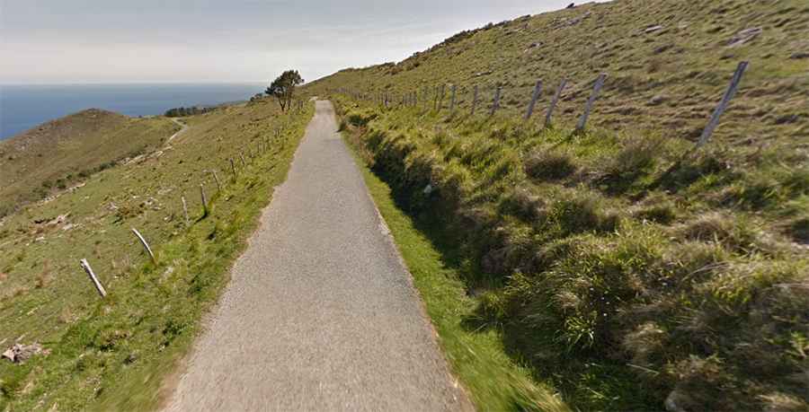
The entire 19.1 km (11.86 miles) route running east-west from Hondarribia to Lezo is fully paved. The driving surface changes character across two distinct sectors: the initial half ascends through dense forest, while the upper section transitions into narrow lanes flanked by open alpine meadows, unprotected coastal cliffs, and viewpoints overlooking the Bay of Biscay coast from Biarritz to Cape Matxitxako.
How steep is the mountain pass of Monte Jaizkibel?
The road features narrow lanes and severe inclines, hitting a 14% maximum gradient on the steepest ramps. Because of this demanding topography, the pass has been the decisive climb in the Clásica de San Sebastián professional cycling race since its founding in 1981. The route experiences heavy traffic spikes from local motorists and cyclists during summer weekends and public holidays.
Road suggested by: jorge manuel gómez sánchez