Conquering the Challenging Road to Alt de Capolat, one of Catalonia's Hardest Climbs
Alt de Capolat is a mountain pass at an elevation of 1,307m (4,288ft) above sea level, located in Spain. Expect a concrete section on the steepest ramps, loose gravel, and slow speeds because it is a narrow, steep, and curvy road.
Where is Alt de Capolat?
The pass is located in the comarca of Berguedà, in the province of Barcelona, in Catalonia, in the northeastern part of Spain.
Why is Alt de Capolat famous?
The pass got viral in the later 2000s when cycling fans tried to find new climbs for the Vuelta España race. The reason was clear: to improve the stages of the bicycle race with alpine-style roads or hill climb roads. But the result was useless.
Can you drive to Alt de Capolat?
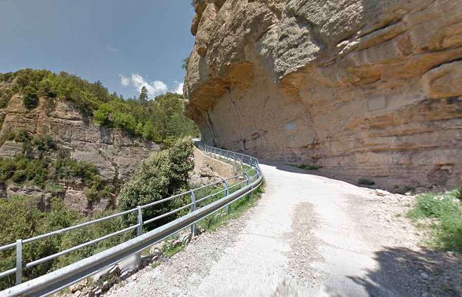
The road to the summit is entirely paved. Built in 1959 by the construction company Serrerías del Llobregat S.A with picks and shovels, it was fully paved in 2008. The road crosses the defiant Congost de Malpás, a picturesque gorge carved by the Ora River. A metal plaque on the rock reminds the fact.
How long is Alt de Capolat?
The pass is 17.9 km (11.12 miles) long, running south-north from C26 Road, to the west of L'Espunyola, to BV-4241 Road, beyond Túnel de Capolat.
How hard is Alt de Capolat?
The climb is extremely challenging. The road is quite grippy, has loose gravel in some parts, and features extremely narrow parts (about 3.5 m wide), totally impassable for two medium cars at the same time.
Is Alt de Capolat steep?
Set high in the Sierra dels Tossals mountain range, the road is brutally steep. It has 12-14-16-18 gradients, topping out at 22%. It’s said to be one of the most impressive kilometers that we can find throughout Catalonia, with no less than 14%, with many peaks between 18 and 20%.