The Triangulo de la Pantaloneta in Spain terrifies Russian and Ukrainian truck drivers
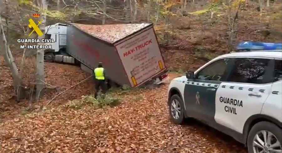
The Triangulo de la Pantaloneta (Pantaloneta Triangle) is a mountainous sector in the Sierra de la Demanda, La Rioja, in Spain, spanning the area between Bañares, Posadas, and Nestares. The narrow forest tracks leading toward Turza near Ezcaray are infamous for trapping heavy articulated trucks following corrupted GPS coordinates.
| Road facts: Triangulo de la Pantaloneta | |
|---|---|
| Location | Sierra de la Demanda, La Rioja (Spain) |
| Primary Road | LR-415 toward Turza (Ezcaray) |
| Sector Boundaries | Bañares, Posadas, and Nestares |
| Hazard Level | High (Extreme narrowness, steep ramps, no turnarounds) |
| Surface | Narrow asphalt transitioning to unpaved forest tracks |
Where is the Triangulo de la Pantaloneta located?
The sector lies in the western mountains of La Rioja, bounded by the municipalities of Bañares, Posadas, and Nestares. The core hazard centers on the narrow LR-415 road that climbs out of Ezcaray toward Turza, an isolated hamlet high in the Sierra de la Demanda.
Why do heavy trucks get stuck in the Triangulo de la Pantaloneta?
A persistent database error in international trucking GPS software misidentifies a nonexistent fuel station and truck stop in Turza instead of the actual logistics hub at La Jonquera on the French border. Long-haul truck drivers routed along the N-120 or A-12 are directed onto local rural roads, climbing steep mountain inclines until the asphalt deteriorates into unpaved forest paths flanked by dense trees.
What are the physical driving hazards on the Turza mountain road?
The ascent along the LR-415 features narrow single-lane track width, steep inclines, tight switchbacks, and zero shoulder clearance. Heavy semi-trailers cannot execute a U-turn once committed to the climb. Drive wheels lose traction on loose dirt and wet leaves, leaving 40-ton vehicles wedged against tree branches and rock faces, requiring heavy industrial cranes for extraction.