The Ultimate Guide to Traveling the Road to Pico Mencilla
Pico Mencilla is a high mountain peak at an elevation of 1.934m (6,345ft) above the sea level, located in the province of Burgos, in the northeastern part of the autonomous community of Castile and León, in Spain.
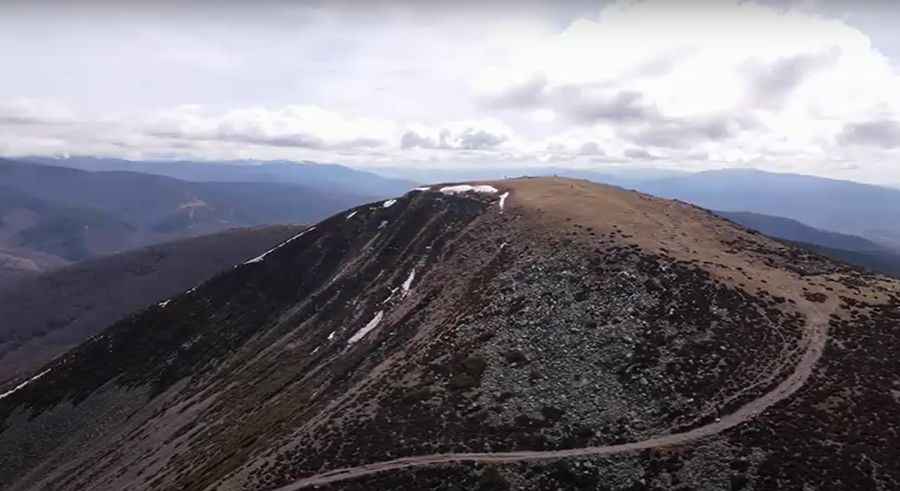
Set high in the Sierra de la Demanda range, the road to the summit is totally unpaved. A 4x4 vehicle is required. When the snow falls - which it does in the winter – things get tough and slippery.
Tucked away on the northern part of the country, the road is 28.1 km (17.46 miles) long, running west-east from Palazuelos de la Sierra to Barbadillo del Pez. It’s the highest point of the road. The road climbs up to 9 mountain passes: Mogosa 1.782m (5,846ft), Alto de Cabeza Bellosa 1.771m (5,810ft), Alto de Hontanares 1.806m (5,925ft), Pico Riscal 1.665m (5,462ft), Cerro de Fray Tuerto 1.670m (5,479ft), Alto de Crucejas 1.606m (5,269ft), Alto del Torruco 1.567m (5,141ft), Alto de La Cuerda 1.418m (4,652ft).
To drive the road without stopping will take most people between 2 and 3.5 hours. The road is very steep, hitting a 24% of maximum gradient through some of the ramps.
Pic&video: EPM