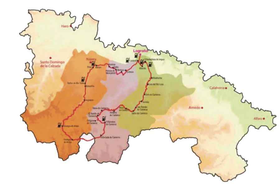
Ruta de los Tres Valles is a Spanish road with 1313 curves
Running through the natural beauty of La Rioja, a Spanish autonomous community, Ruta de los Tres Valles (Route of the Three Valleys) is the name of one of the most intense yet scenic drives in the country.

How long is Ruta de los Tres Valles?
The road is totally paved. Starting at Logroño, the capital of the autonomous community worldwide-known for its red wines, the drive is 189 km (117 miles) long, running through beautiful landscapes, chapels hidden in the heart of nature, natural viewing points and vineyards.
How long does it take to drive Ruta de los Tres Valles?
To drive the road without stopping will take most people between 4 and 5 hours. The drive goes through 29 towns and villages and runs along the banks of the Najerilla, Iregua and Leza rivers. The road climbs up to Puerto de La Rasa, at 1.389m (4,557ft) above the sea level and Puerto de Montenegro, at 1.592m (5,223ft) above the sea level. An innovative signage has been installed on the road, specifically for motorcyclists, recommending the most appropriate way to face the turns.
Stages of Ruta de los Tres Valles:
Valle del Najerilla: 652 turns. 77km (47 miles) long: Alesón, Tricio, Baños de Río Tobía, Bobadilla, Anguiano, Viniegra de Abajo, Viniegra de Arriba.
Valle del Iregua: 397 turns. 72km (44 miles). Entrena, Medrano, Hornos de Moncalvillo, Sotes, Ventosa, Villoslada de Cameros, Villanueva, de Cameros, Ortigosa de Cameros, El Rasillo de Cameros, Nieva de Cameros, Almarza de Cameros.
Valle del Leza: 386 turns. 53 km (32 miles). Muro en Cameros, Jalón de Cameros, San Román de Cameros, Terroba, Soto en Cameros, Leza del Río Leza, Ribafrecha, Villamediana de Iregua, Alberite, Lardero.