Driving the technical track to Valdecebollas: The 2.141m Torreón of Palencia
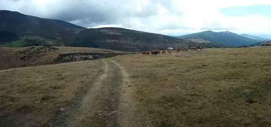
The unpaved track to Mount Valdecebollas is a high-altitude mountain route located in the Montaña Palentina region, within the province of Palencia, northern Spain. The dirt path climbs the eastern sector of the Cantabrian Mountains, terminating at the concrete tower monument known as El Torreón at 2,141 meters (7,024 ft) above sea level.
| Road facts: Valdecebollas | |
|---|---|
| Location | Brañosera, Palencia, Spain |
| Max Elevation | 2,141 m (7,024 ft) |
| Length | 10.6 km (6.5 miles) |
| Max Gradient | 17.9% |
| Surface | Unpaved / Limestone Rock, Dirt & Grass |
What is the route profile from Brañosera to Valdecebollas?
The mountain track spans 10.6 km (6.5 miles) in length, starting from the town of Brañosera. The alignment climbs from the lower valley pastures up to the barren limestone summit crest at 2,141 meters altitude. The route maintains an average upward gradient of 9.03%, but the final mountain sections feature steep ramps that reach a maximum incline of 17.9% over loose stone foundations.
What is the road surface of the Valdecebollas track?
The entire 10.6-kilometer track is completely unpaved. The lower sectors consist of a dirt base mixed with grass, which transitions into sharp limestone ruts and loose shale on the upper slopes. The lane is single-car width with narrow dirt shoulders flanked by open mountain drop-offs. The route completely lacks steel guardrails, concrete safety barriers, or nighttime illumination lines.
How does weather affect driving conditions on Valdecebollas?
Rainfall quickly alters the dirt and grass sectors, creating deep mud ruts that cause wheels to spin and slip on the steep 17.9% ramps. From November to May, winter snowstorms and heavy drifts block the track lanes entirely, closing vehicle access to the summit. Dense ground fog banks develop rapidly across the high pastures, reducing horizontal driving visibility to less than five meters.
What are the mechanical demands of the Valdecebollas climb?
The combination of a 17.9% incline and loose limestone rocks requires a four-wheel-drive vehicle equipped with high ground clearance and low-range gearing to avoid chassis scraping. The 10.6-kilometer downward return to Brañosera puts a heavy thermal load on the vehicle's braking system, requiring low gears and engine braking to avoid brake pad fading. The route has zero cellular signal coverage, fuel stations, or roadside recovery infrastructure past the village of Brañosera.
Road suggested by: jorge manuel gómez sánchez
Pic&video: amigobicimontana