The road to Alto de Despiernacaballos is a hidden gem
Alto de Despiernacaballos is a high mountain pass at an elevation of 1.580m (5,183ft) above sea level, located in the province of Jaén, in Spain.
Where is Alto de Despiernacaballos?
The pass is located in the eastern part of the autonomous community of Andalusia, in the southern part of the country, within the Sierras de Cazorla, Segura y Las Villas Natural Park.
Is the road to Alto de Despiernacaballos paved?
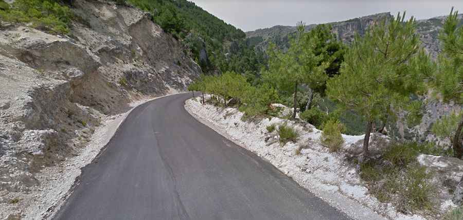
The road to the summit is paved but narrow and steep. It was fully asphalted in 2012. It was improved to shorten the distance through the towns of the Segura Valley.
How long is the road to Alto de Despiernacaballos?
Starting from the challenging yet scenic JF-7038 road, the drive is 11.6 km (7.20 miles) long, and runs from La Toba towards Santiago de la Espada.
How steep is the road to Alto de Despiernacaballos?
The climb has been featured in the Vuelta a Andalucia, a professional cycling race. The road is really steep, with an average gradient of 5,8% and hitting a grueling 21,8% through some of the ramps.
Is the road to Alto de Despiernacaballos open in winters?
Tucked away in the Sierra de Segura mountain range, the road can be accessed year-round but may be closed for short periods in winter when the weather is bad. It is prone to rockfalls and landslides after rains.
Road suggested by: jorge manuel gómez sánchez