Road trip guide: Conquering Puerto de Cienfuegos
Puerto de Cienfuegos is a high mountain pass at an elevation of 1.674m (5,492ft) above the sea level, located on the boundary of the province and autonomous community of Asturias and Leon province, in the autonomous community of Castile and León, in northern Spain.
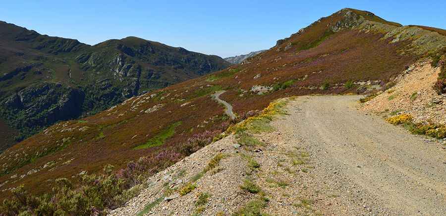
Tucked away in the Sierra de Ancares mountain range, the road to the summit, also known as Alto de Cienfuegos, is totally unpaved. 4x4 vehicle recommended. Always check the weather forecast before you start your journey: adverse conditions are common. The pass is 12.5 km (7.76 miles) long, running from AS-212 road (on Fresno) towards LE-4212 road. The drive is really steep, hitting a 25% of maximum gradient through some of the ramps.
The pass links Luiña valley (in Asturias) and Fornela valley (in León). The road to the summit was built to carry coal to Anllares, a large thermal power station, in Paramo de Sil (León). Back to that time, a cable car was built near the summit. The remnants of a 500-meter-long tunnel are still visible. Not recommended to cross it.
Road suggested by: jorge manuel gómez sánchez
Pic: Isidro Fernández