How to drive the unpaved road to Pico Telégrafo, the highest point of Sierra Arana in Granada
Pico Telégrafo is a high mountain peak at an elevation of 1,977m (6,486ft) above sea level, located in the province of Granada, Spain.
| Road facts: Pico Telégrafo (Sierra Arana) | |
|---|---|
| Location | Granada, Andalusia, Spain |
| Elevation | 1,977 m (6,486 ft) |
| Length | 15.3 km (9.5 miles) |
| Max Gradient | 14% |
| Hazard Level | High (Poorly maintained / Rocky) |
Where is Pico Telégrafo?
The peak, also known as Cerro Arana or Alto del Telégrafo, is located just north of the city of Granada, in the autonomous community of Andalusia, in the southern part of the country.
Why is there a road to Pico Telégrafo?
The summit hosts a communication station.
Is the road to Pico Telégrafo unpaved?
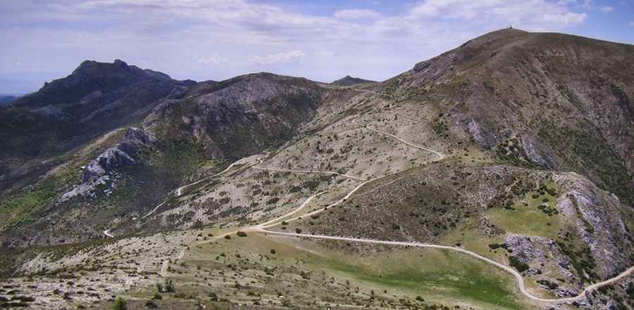
The road to the summit is totally unpaved and poorly maintained, with loose rocks, deep ruts, and sections where the mountain soil has been heavily eroded by winter runoff. A high-clearance 4x4 vehicle is absolutely required.
How long is the road to Pico Telégrafo?
Starting from the town of Deifontes, the road to the summit is 15.3 km (9.5 miles) long. Over this distance, the elevation gain is 1,038 meters and the average gradient is 6.78%, though the drive is tough: the climb is pretty steep, hitting a 14% maximum gradient on several ramps.
How to drive to Collado del Cabrito and Collado del Agua?
On the way to the summit, the road climbs up to Collado del Cabrito (at an elevation of 1.876m-6,154ft above sea level) and Collado del Agua (at 1.712m -5,616ft above sea level).
Is the road to Pico Telégrafo open in winters?
Set high in the heart of the Sierra Arana (also known as Sierra Harana), the road is usually open throughout the year, but its high elevation means that short to medium-term closures in winter are common. When snowfalls hit the Sierra Arana, the unpaved track becomes treacherous and often impassable even for the best-equipped 4x4s.
Road suggested by: jorge manuel gómez sánchez
Pic: Ignacio Diaz Triviño