Llanada del Mulhacen: The Road That Has It All
Llanada del Mulhacén is a high mountain plateau at an elevation of 3,408m (11,181ft) above sea level, located in the province of Granada, Spain. It’s one of the highest roads in Europe.
Where is Llanada del Mulhacen?
The plateau is located in the region of Andalusia, in the south of the Spanish Peninsula, within the Sierra Nevada National Park. It’s situated to the east of Pico del Veleta, the highest paved road in Europe.
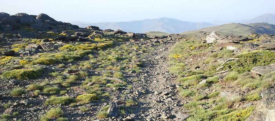
Is the road to Llanada del Mulhacen unpaved?
The road to the summit is completely unpaved. Starting from Alto del Chorrillo, the old track was built in the 19th century to transport equipment for the construction of the geodesic link between Europe and Africa, at the summit of Mulhacén, the highest peak in the Iberian Peninsula.
Is the road to Llanada del Mulhacen open to vehicles?
The track was closed to motor vehicle traffic in the early 1990s. It is currently poorly maintained. To protect the wild nature of the national park, the road is now closed to all types of vehicles, including bicycles. Set high in the Penibética mountain range, be cautious of snow fields and strong winds. Conditions to reach the summit in winter can be extremely harsh.
Is the road to Llanada del Mulhacen worth it?
The views are truly unique, offering panoramic views of nearly all the high peaks of Sierra Nevada (including Veleta, Cerro de los Machos, Alcazaba, Caballo, Vacares, and Cerro Pelao). It’s one of the highest roads in the country.
Travel guide to the summit:
- Stretch 1: Capileira to Aparcamiento Hoya del Portillo. Paved road until approximately 1,800m above sea level.
- Stretch 2: Aparcamiento Hoya del Portillo (parking lot) to Alto del Chorrillo. Wide track.
- Stretch 3: Alto del Chorrillo to Llanada del Mulhacén.
Road suggested by: jorge manuel gómez sánchez
Pic: José Angel De la peca