Is the road to Cap de Vaques in the Pyrenees difficult to drive?
Reaching Cap de Vaques is a short but brutal climb into the high peaks of the Alta Ribagorça. At 2,312m (7,585ft) above sea level, this summit sits at the top of the Boí Taüll ski resort in the Catalan Pyrenees. This isn't a mountain pass for tourists; it’s a rugged, unpaved service track that tests your traction and your nerves. If you're looking for a smooth drive, stay in the parking lot—once you leave the asphalt at the resort base, the mountain takes over. It's one of the highest roads in the country.
| Road facts: Cap de Vaques | |
|---|---|
| Location | Lleida, Catalonia (Spain) |
| Elevation | 2,312m (7,585ft) |
| Length | 1.5 km (0.9 miles) |
| Max Gradient | 25% |
| Surface | Unpaved / Loose Rocks / 4x4 Only |
How long is the road to Cap de Vaques?
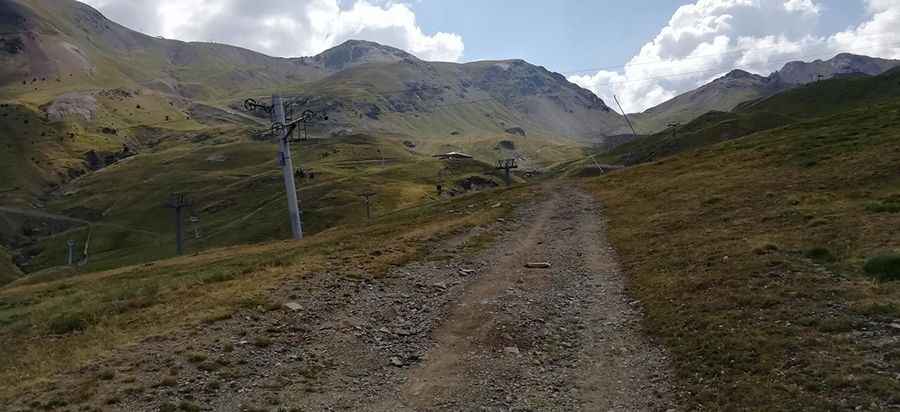
The climb starts directly from the parking lot of the Boí Taüll ski resort. It’s a short 1.5 km burst, but don't let the distance deceive you. In that short stretch, you are tackling extreme gradients that hit 25% in some sections. The road is a chairlift access trail that zig-zags under the cables, offering no breaks for your cooling system or your brakes. It’s a low-range gear climb from start to finish, where the focus is entirely on keeping your momentum without spinning your tires on the loose Pyrenean slate.
Is the road to Cap de Vaques unpaved?
The entire route is strictly unpaved. As seen in the local terrain, the surface consists of packed earth and loose, jagged rocks. This is an active ski resort maintenance track, meaning it is narrow, bumpy, and often rutted after summer storms. A high-clearance 4x4 vehicle is mandatory; a standard SUV will likely bottom out or lose its grip on the steep, dusty ramps. There are no guardrails, and the track is bordered by alpine meadows that drop away sharply. If you meet a resort vehicle coming down, be prepared to reverse on a steep slope to the nearest wide spot.
What are the hazards when driving to Cap de Vaques?
The biggest threat at Cap de Vaques is the combination of extreme steepness and high altitude. At over 2,300 meters, your engine will feel the lack of oxygen, especially when fighting the 25% ramps. Snow is another major factor; even in late June, drifts can block the upper sections of the track. The weather in the Vall de Boí can flip from baking sun to a violent hailstorm in minutes, turning the dry dust into a slick mud slide. Because it’s located near the Aigüestortes National Park, environmental rules are strict—stay on the track and don't even think about driving off-road on the fragile alpine grass.
Is the drive to Cap de Vaques worth the effort?
The view from the top is one of the most expansive in the Pyrenees, looking out over the peaks of the Maladeta and the Sant Maurici area. But you won't have much time to look at the scenery while you're driving. The descent back to the resort parking lot is just as dangerous as the climb—you’ll need to use your engine to help slow the vehicle down, or you’ll smell your brakes burning before you’re halfway down. Take it slow, keep your eyes on the ruts, and focus on the road. The mountain is big, the track is raw, and it doesn't give second chances to those who underestimate the incline.
Driving in the high Pyrenees is about respecting the machine and the slope. The road to Cap de Vaques is a test of your vehicle’s low-range capabilities and your own patience. Check your fluids before leaving Taüll, make sure your tires are up to the task of sharp rocks, and stay sharp. The peaks are beautiful, but they are unforgiving when you're driving on a service trail built for tractors. Enjoy the slow grind to the top.
Pic: afagmato