Is the road to Casetón de Ándara Refuge in Picos de Europa difficult?
Reaching the Refugio Casetón de Ándara is a journey into the heart of the Macizo Oriental of Picos de Europa. At 1,720m (5,643ft) above sea level, this high-altitude shelter in Cantabria sits at the end of a raw, unforgiving track. It’s not just a mountain road; it’s a relic of the old mining industry that once dominated these peaks. Today, it serves as a brutal test for 4x4 vehicles and drivers who aren't afraid of sharp stones and vertical drops.
| Road facts: Casetón de Ándara | |
|---|---|
| Location | Picos de Europa, Cantabria (Spain) |
| Elevation | 1,720m (5,643ft) |
| Length | 3.4 km (2.1 miles) |
| Max Gradient | 15% |
| Surface | Unpaved / Sharp Rock / Old Mine Road |
How long is the road to Casetón de Ándara Refuge?
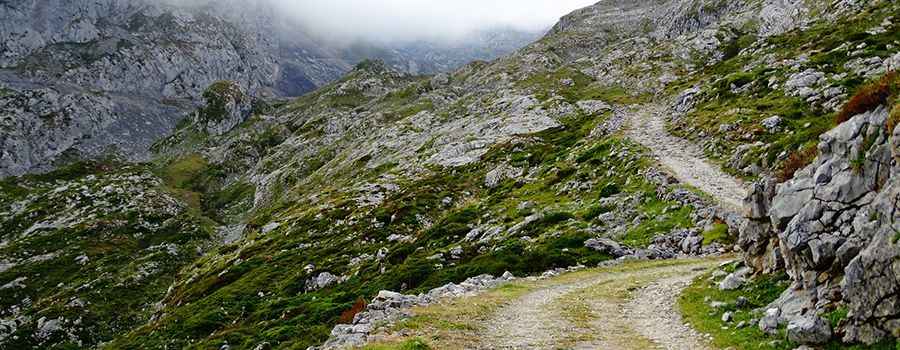
The climb starts from the CA-1 road, near the border with Asturias, and winds up for 3.4 km (2.1 miles). Over this short stretch, you gain 407 meters of elevation with an average gradient of nearly 12%. However, the reality is much steeper, with several sections hitting 15%. The track is narrow and literal carvings into the limestone cliffs, offering zero margin for error. You aren't just driving; you are managing traction on a surface that wants to slide you toward the edge with every turn of the wheel.
Is the road to Casetón de Ándara Refuge unpaved?
The road is completely unpaved and consists of a mix of crushed limestone, loose shale, and large embedded rocks. This is an old mine road, built for durability and heavy loads, not for comfort. A high-clearance 4x4 vehicle is mandatory—not just recommended—to navigate the deep ruts and sharp stones that can easily puncture a standard road tire or scrape the oil pan. The surface is often unstable, especially after rain, making the steep hairpins a challenge for even experienced off-roaders. Expect a bumpy, bone-shaking ride where you'll need to use your low-range gears to keep steady momentum.
What are the hazards when driving to Casetón de Ándara?
The biggest threat on this route is the combination of dangerous drops and unpredictable weather. The track has no guardrails, and in many places, the wheels are just inches away from a vertical fall into the valley below. Picos de Europa is famous for its sudden niebla (fog) that can reduce visibility to zero in seconds, turning the rocky path into a white void. In winter and late spring, the road is buried under heavy snow and is completely impassable for motorized vehicles. Even in summer, falling rocks from the limestone walls above are a constant possibility. This is a high-mountain environment where the road is as wild as the landscape.
When is the best time to drive the road to Casetón de Ándara?
The window for driving this track is narrow, typically from late June to early October. Before then, snow patches block the higher sections, and the melting ice makes the ground too soft and dangerous. If you decide to go, check the forecast for the Liébana region—storms here are violent and fast. Always remember that this is a protected area within the National Park; stay on the established track to avoid damaging the fragile alpine ecosystem. Lower your tire pressure slightly for better grip on the loose stones, keep a steady pace, and don't turn your back on the cliffside.
Driving to Casetón de Ándara is a reminder of the raw power of the Cantabrian Mountains. It’s a short, intense journey that requires a solid vehicle and a calm head. The refuge, a former mining office, stands as a lonely outpost in a sea of rock. Watch your lines, respect the incline, and focus on the road. The Picos don't give second chances to those who ignore the grit of the terrain. Stay sharp.
Pic: Rober