What are the most spectacular roads in Spain?
Tucked away on the Iberian Peninsula, in the southwestern part of Europe, the roads of Spain offer the best way to discover the country’s diverse topography. It features mountain roads, even the highest paved road in Europe, as well as stunning coastal drives on the Balearic Islands and the Canary Islands.
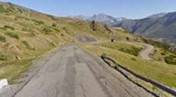
The country is home to Pico del Veleta, the highest paved road in the European continent. Ending at 3,369m (11,053ft) above sea level, it's one of the highest roads in Europe. At an altitude of around 3,000m, road conditions become significantly worse. For those seeking mountain roads, Alto de l’Angliru is the ultimate cycling ascent in Asturias. Climbing up to 1.558m (5,111ft) above sea level, it’s one of the hardest and most epic climbs you can ride on two wheels.
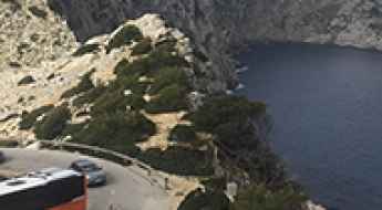
If you’re up for a drive on scenic roads, Mallorca hosts two stunning drives: the sensational road to Formentor Lighthouse and Sa Calobra, the Snake Road. Located on the island of Mallorca, Sa Calobra Road is one of the most scenic drives in the world. Imagine dropping a long piece of wet spaghetti on the floor. The pattern it makes looks something like what the road looks. If you really want a challenge, try tackling it by bike. On the Canary Islands, GC-200 is an exhilarating road with 365 curves and spectacular views. The road has it all, from hairpin bends to sheer cliff-edge drops. It's one of the best roads on the Canary Islands.
So, rev up your engines and let Spain's spectacular routes guide you through a journey of soulful discoveries and unforgettable vistas. You will discover many treasures created by skilled workers employed by construction firms with tradition in Spain.
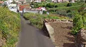
Calle Monroy is one of the steepest streets in the world
Located in Tenerife, on the Canary Islands of Spain, Calle Monroy is one of the steepest streets in the world with an average gradient of 28.1%.
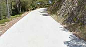
Driving the paved road to the Haunted Laguna Negra
Laguna Negra de Urbión (Black Lagoon of Urbión) is a glacial lake situated at an elevation of 1,731m (5,679ft) above sea level. It's located in the northern part of the province of Soria, in Spain. Many believe that the lagoon is haunted.
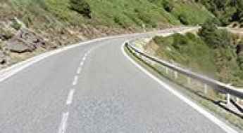
Driving the scenic road to Puerto de las Señales in the Cantabrian Mountains
Puerto de las Señales is a high mountain pass at an elevation of 1.629m (5,344ft) above sea level, located in the province of Leon, in Spain.
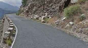
Traveling the scenic Carretera de la Cabra (Road A-4050)
Located in the province of Granada, in Spain, the A-4050 is one of the most scenic drives in the southern part of the country. Drive with care as this is a mountain road with hairpin turns. This is the old road from the coast to Granada city, locally named Carretera de la Cabra or The Goat's Path.
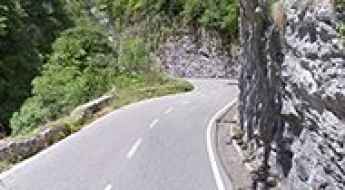
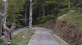
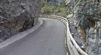
The narrow road through Desfiladero de los Beyos
Desfiladero de los Beyos is an amazing gorge with vertical walls carved by the erosion of the Sella River, located in Spain. It’s one of the most scenic canyon roads in the country.
Collada de Toses in Girona is one of the best roads of Europe
Collada de Toses is a high mountain pass at an elevation of 1.800m (5,905 ft) above sea level, located in the province of Girona, in the autonomous community of Catalonia, in Spain.
Carretera de las Presas (Road GC-605) is not for the faint-hearted
Known as Carretera de las Presas, the GC-605 is a wonderful and scenic, dangerous mountain road located in the southwestern part of the island of Gran Canaria, in the Canary Islands of Spain. The maximum slope is 10%.
Climbing the steep road to Alto de Xorret de Cati in Valencia Region
Alto de Xorret de Catí is a mountain pass at an elevation of 1.097m (3,599ft) above sea level, located in the province of Alicante, in the Valencia region of Spain.
A narrow road to the wild Picon Blanco in the Cantabrian Mountains
Picón Blanco is a high mountain peak at an elevation of 1.512m (4,960ft) above sea level, located in the province of Burgos, in the autonomous community of Castile and León of Spain.
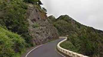
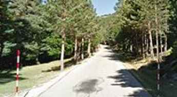
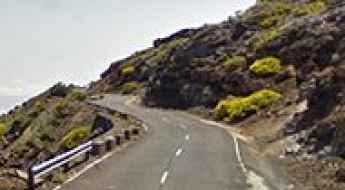
Driving the Curvy TF-12 Road in the Canary Islands
Located on the island of Tenerife, in Spain’s Canary Islands, the TF-12 road is, probably, one of the most enjoyable routes to cycle in the whole of Spain. This quiet highway cuts through the Anaga mountain range.
A paved road to Collado de Llesba with terrific views of Picos de Europa
Collado de Llesba is a high mountain pass at an elevation of 1,682m (5,518ft) above sea level, located in the west of the province of Cantabria, near Castile and León, in Spain.
Pista Espinama-Sotres is a Tricky Scenic Drive in the Picos de Europa
The road from Espinama to Sotres is an exhilarating route that straddles the autonomous communities of Asturias and Cantabria in Spain.
A wild paved road to Boi-Taull in the heart of the Pyrenees
Boi-Taüll is a ski resort at an elevation of 2.055m (6,742ft) above sea level, located in the heart of the Pyrenees, in the province of Lleida, in the autonomous community of Catalonia, in Spain.
How To Have The Ultimate Road Trip To Pico Agujas
Pico Agujas is a high mountain peak at an elevation of 2,101m (6,893ft) above sea level, located in the province of León, in the northwestern part of the autonomous community of Castile and León, in Spain.
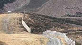
Los Machucos is one of the steepest roads in Spain (31%)
Los Machucos is a mountain pass at an elevation of 880m (2,887ft) above sea level, located in the Autonomous Community of Cantabria, in Spain. It’s one of the steepest roads that a Spanish bike race has ever tackled, where you ride directly uphill over a huge rock. The climb is brutal, with gradients reaching up to 31%.
The collapsed Engaña Tunnel: a real deathly risk
Túnel de la Engaña is a never-completed railway tunnel with a length of 6.9km (4.28 miles), located in the northern part of Spain. The tunnel was intended to connect the provinces of Burgos and Santander. After the collapse of some parts of the structure in 1999 and 2005, access to the tunnel is extremely dangerous.
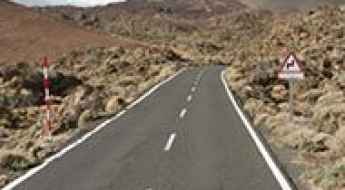
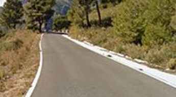
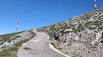
Base del Teide is one of the most sensational roads in the Canary Islands
Base del Teide is a high mountain cable car base station at an elevation of 2.356m (7,729ft) above sea level, located in Tenerife in the Canary Islands. It's one of the highest roads in the country.
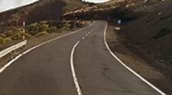
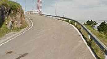
Driving the paved road to Puerto de Izaña
Puerto de Izaña is a high mountain pass at an elevation of 2,263m (7,424ft) above sea level, located in Tenerife on the Canary Islands of Spain.
The Brutal Climb to Peña Escrita in Granada with 27% Gradients
Peña Escrita is a mountain peak at an elevation of 1,175m (3,854ft) above sea level, located in the province of Granada, in Spain. The climb is simply terrible, featuring gradients going up to 27%.
Driving the Enthralling A-7000 Road with Two Pigtails in Andalusia
A-7000 is an awe-inspiring road located in Malaga province, in Spain. It features 2 pigtails, turns that loop over their own road, allowing the road to climb rapidly.
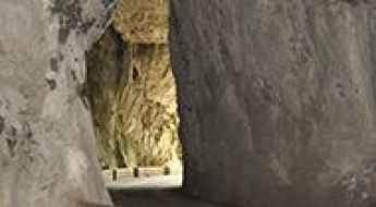
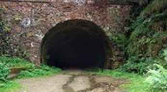
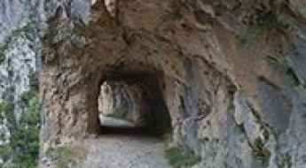
La Cuevona is one of the few caves you can drive through by car
La Cuevona is a natural cave located in the autonomous community of Asturias, Spain. Driving through this vast cavern is the only way to access the nearby village, making it a truly unique experience. It’s one of the few roads in the world that runs through a cave.
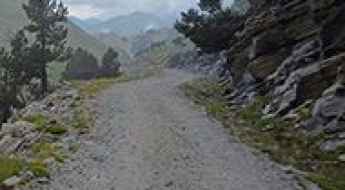
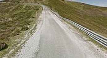
Pista de las Cutas: A Scenic Gravel Road in Ordesa
Pista de las Cutas is one of the most scenic drives in Spain. Located in the northwest of the Sobrarbe region, in the province of Huesca, Spain, the road offers spectacular views of Ordesa and Monte Perdido. It is closed to private vehicles.
What are the most challenging and scenic roads in Mallorca?
Mallorca is far more than a Mediterranean beach destination; it is home to the Serra de Tramuntana, a UNESCO World Heritage site featuring some of Europe’s most technical mountain passes. From the legendary 270-degree tie-knot of Sa Calobra to the 52 hairpin bends of Coll de Sóller, driving on the island requires precision, nerve, and an understanding of high-altitude coastal engineering. This guide explores the most demanding routes for those who prefer the thrill of the climb to the calm of the shore.
A classic road trip to Sierra Nevada in Granada
Sierra Nevada is a ski resort at an elevation of 2.385m (7,824ft) above sea level, located in the province of Granada, in Spain. It’s one of the highest roads in the country.
Monestir de Montserrat is the most iconic climb of Catalonia
Monestir de Montserrat is a Benedictine abbey situated at an elevation of 1,236 meters (4,055 feet) above sea level, located on the mountain of Montserrat in Catalonia, Spain.
C31 is a Busy Coastal Road with Sharp Curves and Stunning Views in Barcelona
C31 is a coastal corniche road located in Spain's Catalonia region. The exciting road, nicknamed Costes del Garraf, is not suitable for those who get dizzy.
An otherworldly road to Peña de Francia in Salamanca
Peña de Francia is a high mountain peak at an elevation of 1.708m (5,603ft) above sea level, located in the province of Salamanca, in Spain.
A paved road to Port de Canto in the heart of the Pyrenees
Port de Cantó is a high mountain pass at an elevation of 1.725m (5,659ft) above sea level, located in Alt Urgell comarca, in Spain.
Driving the steep concrete road to Coll de l’Arca in Baix Penedès
Coll de l’Arca is a tough mountain pass tucked away in the Sierra de Montmell. This is not your standard secondary road; it is a narrow forest track that has been covered with concrete to allow vehicles to climb the brutal gradients. The route connects Aiguaviva with La Juncosa del Montmell, offering a direct but punishing path through the limestone hills of Baix Penedès. If you are driving a car with low torque or poor tires, the 15% ramps on this track will quickly show your vehicle's limits.
A brutally steep road to Alto del Gamoniteiro
Alto del Gamoniteiro is an isolated and remote high mountain peak at an elevation of 1,776m (5,826ft) above sea level, located in Asturias, in Spain. The climb is very steep, hitting a grueling 17% through some of the ramps. It’s said to be the highest paved road in Asturias.
Peña Cabarga is one of Spain's toughest cycling climbs
Peña Cabarga is a mountain peak at an elevation of 560m (1,837ft) above sea level located in the autonomous region of Cantabria. It’s said to be one of Spain's toughest cycling climbs.
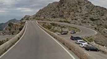
A memorable road trip to Coll dels Reis in Mallorca
Coll dels Reis is a mountain pass at an elevation of 658m (2,158ft) above sea level, located on the northwest coast of the Spanish Balearic island of Mallorca. It’s one of the most visited spots by cyclists on the island.
A scenic paved road to Puerto de Navafría
Puerto de Navafría is a high mountain pass at an elevation of 1.775m (5,823ft) above sea level, located on the border between Castile and Leon and Madrid communities, in Spain.
A scenic drive to Cap de Creus Lighthouse, an inspiration to Dali
Far del Cap de Creus is a lighthouse located in the province of Girona, Spain. Nature has created a marvelous and other-worldly scenery here. The road pierces through crazily tilted rocks and narrows to a single lane leading across a narrow isthmus.
A 5-star road to the top of Puerto de Santa Ines in Soria
Puerto de Santa Inés is a high mountain pass at an elevation of 1.755m (5,757ft) above sea level, located in the province of Soria, in Spain.
Driving to Mont Caro, the Highest Road in Tarragona — Only if You’re Not Afraid of Heights
Mont Caro is a mountain peak at an elevation of 1,447m (4,747ft) above sea level, located in Catalonia, Spain. The summit is heavily built up, partly occupied by large buildings and towering antenna masts. The road to the top is narrow and dangerous, particularly during winter.
Mirador de Ezaro in Galicia: The 28% Gradient Road that Challenges Cyclists
Mirador de Ézaro is a natural viewpoint at an elevation of 268 meters (879 feet) above sea level, located in the province of A Coruña, Spain. It’s one of the steepest roads that a Spanish bike race has ever tackled, where you’ll be riding directly uphill over a huge rock.
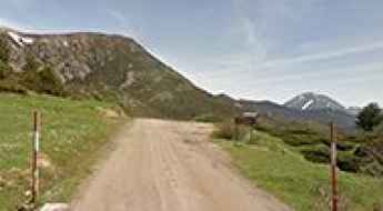
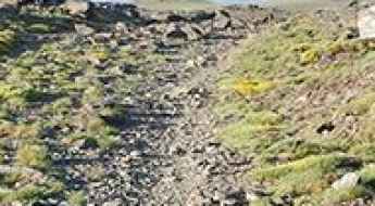
A wild unpaved road to the summit of Pico Tres Mares
Pico Tres Mares is a high mountain peak at an elevation of 2.139m (7,017ft) above sea level, located in Spain.
Panta de Cavallers: a steep paved road to the reservoir
Pantà de Cavallers is a high mountain reservoir at an elevation of 1.770m (5,807ft) above sea level, located in the province of Lleida, in Catalonia, Spain.
Driving the scenic road to Port-Aine in the Pyrenees
Port-Ainé is a ski resort at an elevation of 1.967m (6,453ft) above sea level, located in the province of Lleida, in Spain.
Garganta del Cares: One of the Most Difficult Roads in Spain
Garganta del Cares is a very narrow canyon located in the province of León in Spain. It’s one of the most scenic canyon roads of Spain.
Driving the Beautiful LP-4 Road in the Canary Islands
Carretera LP-4, locally known as Carretera del Roque, is a breathtaking road located in the province of Santa Cruz de Tenerife in the Canary Islands. It's one of the highest roads in Spain.
Llanada del Mulhacen: The Road That Has It All
Llanada del Mulhacén is a high mountain plateau at an elevation of 3,408m (11,181ft) above sea level, located in the province of Granada, Spain. It’s one of the highest roads in Europe.
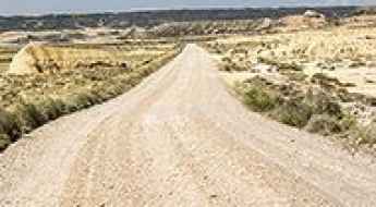
Driving through Bardenas Reales, one of only a few deserts in Europe
Bardenas Reales is a desert natural region located in southeast Navarre, in Spain. It’s one of the few deserts in Europe and is definitely the most impressive of them all.
A breathtaking hike through the Cares Gorge: Ruta del Cares
Ruta del Cares, also known as Senda del Cares, is one of the most breathtaking trekking trails in Europe. Located within the Picos de Europa mountain range in northern Spain, the trail takes you through dramatic landscapes along a narrow path carved directly into the rock of the Cares Canyon, also known as The Divine Gorge. This trail is not suitable for vehicles, as it is completely closed to any kind of motor transport. Only hikers can enjoy the stunning views along the route.