How to Drive the Road to the Isles in Scotland?
Located in the Highlands of Scotland, the Road to the Isles is one of the best drives in the country, with plenty to see along the way and some of the most spectacular scenery in the world.
How long is the Road to the Isles?
This very scenic drive is 40.6 miles (65.3 km) long, running east-west and linking Fort William (a town in the western Scottish Highlands, on the shores of Loch Linnhe) and Mallaig (a port town on the west coast of the Highlands of Scotland). This route passes the Glenfinnan Monument, sandy beaches, and beautiful coastline before reaching Mallaig, where you can catch a ferry to the Isle of Skye and the Small Isles. Driving time, including the alternative coastal route, is 1.5 hours, but allow half a day to stop and explore.
Is the Road to the Isles paved?
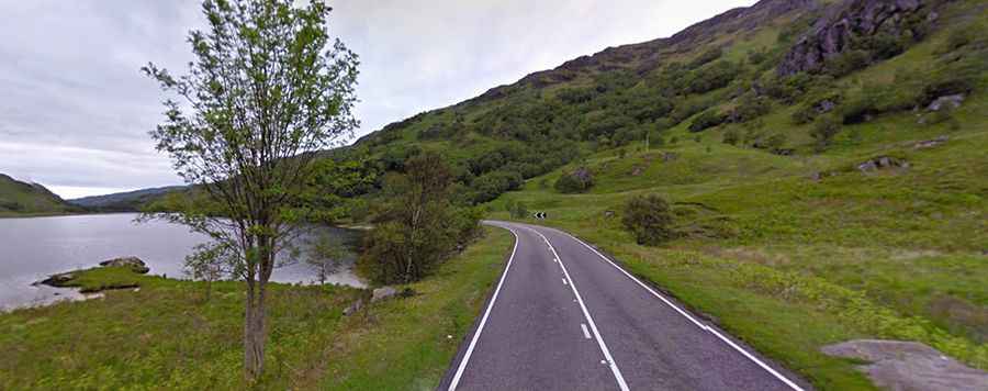
Located on the western coast of North Scotland, the road (officially known as the A830 road) is entirely paved, running through wild landscapes and the Highland heights. Along this scenic route, made famous by a song, there are lots of places to stop. The best time to drive it is spring and fall to avoid the crowds.
Is the Road to the Isles in Scotland worth it?
The drive is definitely worth it—a drive not to be missed! The drive takes in historic sites as well as beautiful Scottish countryside. From the mountains around Ben Nevis to Loch Shiel and then to stunning beaches and views of islands, this drive will please everyone. Dotted with small Scottish towns and with no shortage of scenery, the aptly named Road to the Isles is one of Scotland's most beautiful drives. The views are spectacular on a fine day (or dramatic if the weather is not so fine). Here you will see some of the most spectacular scenery in the world—from sandy beaches to dramatic hills, green woodlands, heather moors, unforgettable sea views, and magnificent sunsets over the Isles of Rum, Eigg, Muck, Canna, Skye, and the remote wilderness of Knoydart.