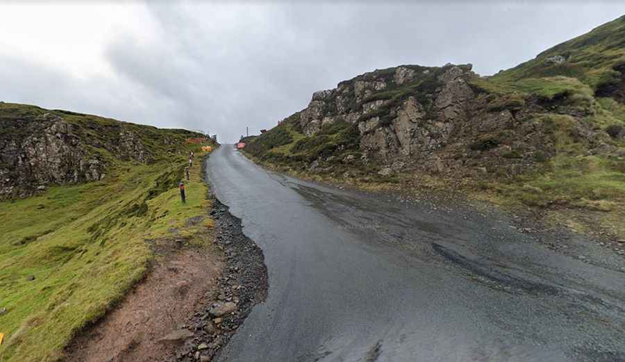
A scenic steep road to Quiraing Pass on the Isle of Skye
Quiraing Pass is a mountain pass at an elevation of 261m (856ft) above sea level, located in the Scottish council area of Highland on the Isle of Skye, with steep gradients and tight bends.
Where is Quiraing Pass?
The pass, also known as Cuith-raing, is located on the northern part of the Isle of Skye, on the western part of the country.
Can you drive through the Quiraing?
The road to the summit is totally paved in good condition. The pass is 10.62km (6.6 miles) long, running east-west from Stenscholl to Idrigill.
Is the Quiraing pass difficult?
The road to the summit is very steep, hitting a 14% maximum gradient through some of the ramps, winding upwards along the steep massif. It is a winding single paved track, with hairpin turns and very narrow.
Is the Quiraing pass open?
Set high on the eastern face of Meall na Suiramach, the northernmost summit of the Trotternishon, the road may be closed in winters. The road conditions make it not recommended in windy conditions or if it’s misty (low visibility).
How long does it take to drive the Quiraing pass?
The drive is very scenic, offering stunning views of the Trotternish Range. Plan about 20 minutes to complete the drive without any stops. The road can be quite congested during the busy summer months.
Is the Quiraing pass worth it?
The drive passes through some of the most spectacular landscapes in Scotland, winding through the landscape between the towns of Uig and Staffin. It’s a must-drive for anyone who enjoys the natural scenic landscapes. The road passes through the Quiraing, or Cuith-Raing, a landslip located on the Northern part of Skye (Trotternish Ridge). The entire ridge was created by a series of landslips over time. The Quiraing continues to move today, requiring yearly road repairs at the base. On the pass opens a magnificent view over the Quiraing and Staffin Bay. There is a big car park at the top.