Driving ‘The Road’ through Enforca Caes
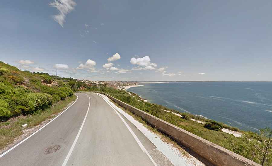
A new coastal road was completed in 2022 in central Portugal. Known informally as “The Road” through Enforca Cães, it runs along the cliffs of Serra de Boa Viagem, providing vehicle and bicycle access between two coastal parishes.
Where is this road?
The road is located in the municipality of Figueira da Foz, in the district of Coimbra, Portugal. It runs along the Atlantic coast from the village of Buarcos to Murtinheira (in the parish of Quiaios), passing through Cabo Mondego and the Serra de Boa Viagem cliffs. It lies within the Cabo Mondego Natural Monument area.
Why is it called Enforca Cães?
"Enforca Cães" translates to "Dog Hanging" in Portuguese. The name refers to a historical practice believed to have occurred in the 19th century, during periods when rabies outbreaks posed a public health threat. Rabid or suspected rabid dogs were reportedly placed in sacks and thrown from the cliffs at Cabo Mondego as a method of disease control. This method reflected the limited veterinary knowledge and lack of treatment options available at the time. The location became associated with this practice and retained the name even after rabies was eliminated in the country. Portugal has been officially rabies-free since 1961. Today, the name serves as a historical reference, though no physical traces of the practice remain. Cabo Mondego and the Enforca Cães area are now part of a protected natural monument zone, known for its geological and scenic significance rather than its former use.
What are the key stats of the road?
The road is 6.4 kilometers (3.97 miles) long and was inaugurated in the summer of 2022. It is fully paved and 5.5 meters wide. A dedicated bicycle lane runs alongside the vehicle lane. The maximum speed limit is 30 km/h. A traffic light system is installed on narrow sections to allow single-direction traffic flow. The road improves access between Buarcos and Murtinheira within the protected coastal zone.
What makes it dangerous?
The road is narrow and runs along exposed cliff edges with sharp curves and limited visibility in some sections. There is no physical barrier along some parts of the cliff side. Weather conditions, such as fog and rain, can further reduce visibility. The traffic light system indicates where only one vehicle can pass at a time. Drivers and cyclists must exercise caution.
What else should visitors know?
Parking is available near key access points, but fees may apply. The road runs through a protected natural area with geological and historical significance. Despite the name, there is no longer any animal-related activity associated with the site. The road is primarily used for scenic driving, cycling, and access to viewpoints along the coast.
Road suggested by: jorge manuel gómez sánchez