How to drive the steep curves of the EN15 to Alto de Espinho?
Alto de Espinho is a mountain pass at an elevation of 1,025m (3,362ft) above sea level, located in the Norte region of Portugal.
| Road facts: Alto de Espinho (EN15) | |
|---|---|
| Location | Serra do Marão (Portugal) |
| Elevation | 1,025 m (3,362 ft) |
| Length | 46.6 km (29 miles) |
| Max Gradient | 9.2% |
Where is Alto de Espinho?
Situated within the Serra do Marão mountain range, this pass marks the boundary between the Porto and Vila Real districts.
Is the EN15 road to Alto de Espinho paved?
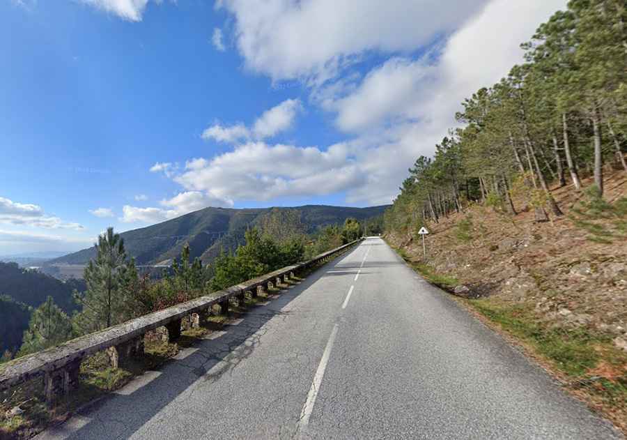
The road to the summit is fully paved but suffers from old, neglected infrastructure. It's called Estrada Nacional 15 (EN15), which was the main road link between Porto and Bragança before the construction of modern highways.
How long is the EN15 road to Alto de Espinho?
Stretching 46.6km (29 miles) from Amarante to Parada de Cunhos, the EN15 is a succession of tight switchbacks, narrow lanes, and blind curves with a maximum gradient of 9.2%. The lack of modern wide barriers on the edge means wheels run inches away from unprotected slopes.
How busy is the EN15 road to Alto de Espinho?
Crossing the Serra do Marão used to be an ordeal. Until the late 1980s, the narrow EN15 was the only truck route across the mountain barrier. Later, the IP4 wide road bypassed the tightest switchbacks, and in 2016, the opening of the A4 motorway and the 5.6km long Túnel do Marão pushed almost all vehicle traffic underground. Today, the EN15 is largely abandoned, leaving the mountain pass completely empty for drivers who want to avoid toll roads or need a detour when the main tunnel is closed for maintenance.
Road suggested by: jorge manuel gómez sánchez