The road to Alto de Torre-Serra da Estrela, the highest point of Mainland Portugal
Alto de Torre is a high mountain peak at 1.996m (6,548ft) above sea level located on the boundary between the Guarda and Castelo Branco districts of Portugal. At this elevation, it’s the highest point of Mainland Portugal. It's one of the highest roads in the country.
Where is Alto de Torre-Serra da Estrela?
The peak is located in the Serra da Estrela Natural Park, in the northeastern part of the country.
Can you drive to Torre-Serra da Estrela?
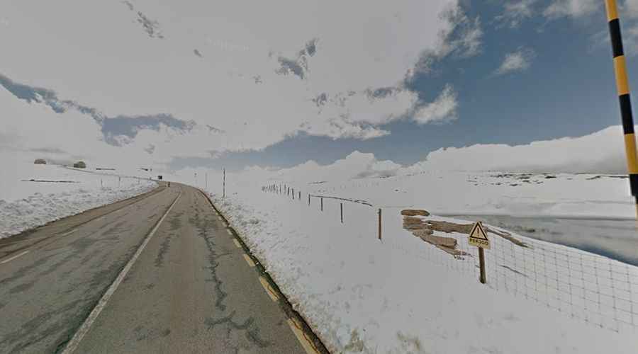
Set high in the Serra da Estrela mountain range, the road to the summit is totally paved. It’s called Regional Road 339 (R 339). The summit is the second most elevated point in the country (only Mount Pico, in the Azores, is higher).
How long is the road to Torre-Serra da Estrela?
The road is 50 km (31 miles) long, starting at Seia to Covilhã. The summit hosts two radar domes, a chapel, stores, and a restaurant. The road is very steep, hitting a 10.4% maximum gradient through some of the ramps.
Is Torre-Serra da Estrela open?
Access to the summit is typically open all year round, with the occasional closure in winter due to dangerous weather conditions. The lowest temperatures in Portugal are recorded on the summit. In cold weather, Serra da Estrela is the only place in Portugal where you can try skiing.
Is the drive to Alto de Torre-Serra da Estrela worth it?
King John the 6th ordered the construction of a stone monument at the summit. In the center of a roundabout is situated the symbolic monument of the “Torre” (Tower). The views are spectacular, and on a bright day, you can see the Atlantic Ocean over 100 miles (161 km) in the distance.