What are the most spectacular roads in Portugal?
Tucked away on the Iberian Peninsula, in the southwestern part of Europe, the roads of Portugal offer the best way to discover the country’s diverse topography. The country hosts stunning mountain roads, such as the wild climb to Alto de Torre-Serra da Estrela, the highest point of Mainland Portugal, climbing up to 1.996m (6,548ft) above sea level on the boundary between the Guarda and Castelo Branco districts. It's one of the highest roads in the country.
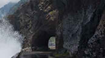
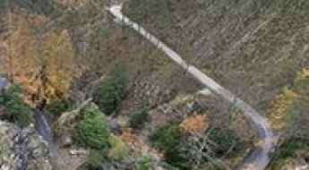
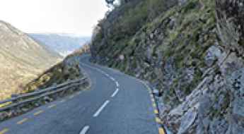
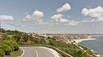
The geography of the country, with extensive beaches and cliffs, offers stunning coastal routes. One of the most scenic drives is ER101 Antiga, a free car wash road in Madeira. Due to Madeira's dramatic coastline, the road boasts many curves, narrow passages, and steep climbs and descents. It's rugged, slow, and old, making it one of the most scenic drives in the world.
If you prefer scenic drives, you can’t skip the National Road 222. The road, running between Peso da Régua and Pinhão, was awarded the title of the world's best road in 2015.
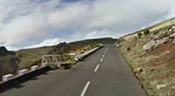
ER101 Antiga is a free car wash road in Madeira
In the northern part of Madeira Island, in Portugal, lies a rather peculiar and dangerous road called Antiga Estrada Regional 101 (ER101). Due to Madeira's dramatic coastline, the road has many curves, narrow passages, and steep climbs and descents. It's one of the most scenic drives in the world.
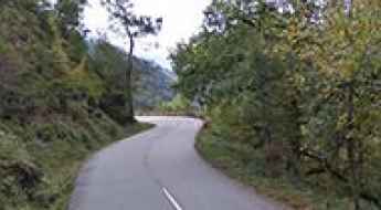
National Road 222 is a sensational road of Portugal
Located in the North Region of Portugal, Estrada Nacional 222, between Peso da Régua and Pinhão, was awarded as the world's best road in 2015.
Driving the brutally steep (45%) Rua da Barreira
Located in Funchal, the capital city of Portugal's Madeira archipelago, Rua da Barreira is one of the steepest roads in the world, with some brutal sections of 45% and an average gradient of 25.17%.
Estrada Nacional 2 is the Route 66 of Portugal
National Road 2 is nicknamed the Route 66 of Portugal. It’s a very exciting and scenic journey in the heart of the country, taking you from Chaves in the north to Faro in the south.
Take the Scenic Route and Discover Pico do Areeiro in Madeira
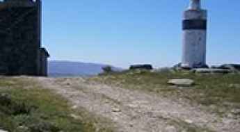
Pico do Areeiro is a high mountain peak at an elevation of 1.804m (5,918ft) above sea level, located in Madeira, a Portuguese archipelago in the North Atlantic Ocean. At this elevation, it is one of the highest roads in the country.
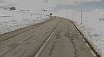
The road to Alto de Torre-Serra da Estrela, the highest point of Mainland Portugal
Alto de Torre is a high mountain peak at 1.996m (6,548ft) above sea level located on the boundary between the Guarda and Castelo Branco districts of Portugal. At this elevation, it’s the highest point of Mainland Portugal. It's one of the highest roads in the country.
Guide to the top of Monte Farinha
Monte Farinha is a mountain peak at an elevation of 940m (3,083ft) above sea level, located in the district of Vila Real, Portugal.
How to drive the steep paved road to Alto de Sao Macario in Portugal?
Alto de São Macário is a mountain peak at an elevation of 1.052m (3,451ft) above sea level, located in the district of Viseu, in Portugal.
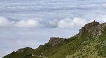
Portal do Inferno e Garra: Stay Away if You're Scared of Heights
Portal do Inferno e Garra (Hell Portal and Claw) is a natural viewpoint at an elevation of 984m (3,228ft) above sea level, located on the boundary between the Viseu and Aveiro districts of Portugal.
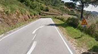
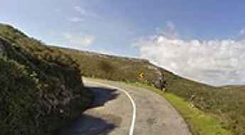
N232 Road is not suitable for those who get dizzy
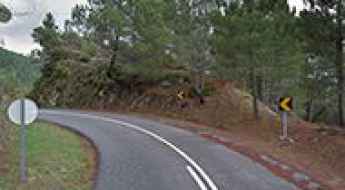
Located in central Portugal, N232 Road is a tortuously winding mountain road. The road has so many twists and switchbacks that it is best avoided.
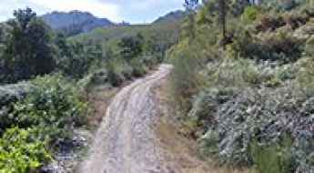
A narrow unpaved road to Covas do Monte in Portugal
Covas do Monte is a small town at an elevation of 536m (1,758ft) above sea level, located in the municipality of São Pedro do Sul, in Portugal.
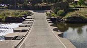
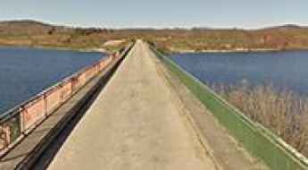
How to cross the international Vado del Río Eljas
Vado del Río Eljas is an international low-water bridge located on the border of Spain and Portugal. Linking the province of Cáceres (Spain) and the Centro region (Portugal), this 52.31-meter concrete passage is a crossing point between the villages of Valverde del Fresno and Monfortinho. It is one of the most spectacular bridges in the world.
If You Love to Drive, You'll Love the N308-1 Road
N308-1 is a scenic, winding, and narrow zig-zag road located in the northern part of Portugal, in the district of Braga, near the border with the Province of Ourense in Spain.
Poço do Inferno Waterfall, a sensational drive
Cascata Poço do Inferno (Hell's Well) is a spectacular ravine/waterfall about 10 feet high located in Centro Region and Beira Interior Norte Subregion, in Portugal. The road has some narrow parts, impassable for 2 medium cars.
Driving the scenic EM513 Road to Alto de Vaires
Alto de Vaires is a mountain pass at an elevation of 1,288 m (4,225 ft) above sea level, located in Vila Real District, in Portugal.
Pico da Barrosa
Pico da Barrosa is a mountain pass at an elevation of 936m (3,070ft) above the sea level located in the island of São Miguel in the Portuguese Azores. At the summit it’s possible to see both the North and South Coasts.
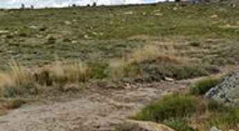
A rough 4x4 road to Poios Brancos
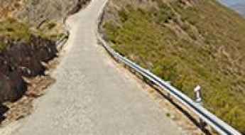
Poios Brancos is a high mountain peak at an elevation of 1.685m (5,528ft) above the sea level, located in the district of Guarda, in the Centro Region of Portugal. It's one of the highest roads of the country.
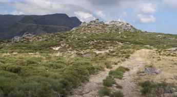
What are the highest roads in Portugal?
With a rich history of seafaring and discovery, the Portuguese Republic is situated at the western end of the Iberian Peninsula in southwestern Europe. Bounded by the Atlantic Ocean and Spain, the country enjoys a generally mild climate, but its geography is far from homogeneous. While much of the territory consists of rolling hills and coastal plains, the rugged interior is dominated by key mountain ranges, most notably the towering Serra da Estrela.
Travel guide to the top of Achada do Teixeira
Achada do Teixeira is a high mountain plateau at an elevation of 1.593m (5,226ft) above the sea level, located in the Portuguese island of Madeira.
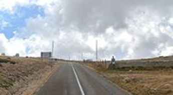
Take the Scenic N339 and Discover Col de Zezere
Col de Zezere is a high mountain pass at an elevation of 1.615m (5,298ft) above the sea level, located in the district of Castelo Branco, in Portugal. It's one of the highest roads of the country.
Best Things to do in Portugal
Lisbon, Portugal’s capital city is beautiful and enchanting. A fusion of history, a vibrant nightlife and a bohemian art scene, Portugal is a city that is truly alive.
Montejunto
Montejunto is a mountain peak at an elevation of 655m (2,148ft) above the sea level, located in centre west of Portugal. At the summit there are some churches and chapels, and several communication facilities.
Travel guide to the top of Alto da Pedrice
Alto da Pedrice is a high mountain peak at an elevation of 1.740m (5,708ft) above the sea level, located in Castelo Branco district, in Central Portugal. It's one of the highest roads of the country.
Driving the Scenic N379-1 Road with Stunning Views of the Atlantic Ocean
N379-1 Road is perhaps the most scenic drive in Portugal. Located south of the capital, this road offers a mix of smooth and challenging curves, with breathtaking landscapes. It’s often called the Portuguese version of California's Pacific Coast Highway.
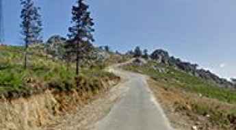
Driving the Exciting ER338 Road in Serra da Estrela
Nestled in the Guarda district of Portugal, high within the Serra da Estrela mountain range in the central part of the country, lies the stunning ER338 Road. This fully paved route, stretching for 28.1 km (17.46 miles) from Col de Zezere to Manteigas, offers a very exciting drive with truly great views. However, it's important to note that this scenic passage can be closed at any time due to security concerns.
Road trip guide: Conquering Pico da Santinha
Pico da Santinha is a high mountain pass at an elevation of 1.597m (5,239ft) above the sea level, located in the district of Guarda, in the Centro Region of Portugal.
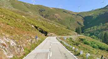
N304 Road is one of the best drives in Europe
Located in the Vila Real District of Portugal, N304 is recognized as one of the best driving routes in Europe, according to Ford Magazine.
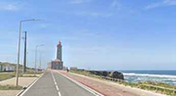
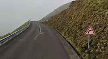
Is the Atlantic Road the Most Breathtaking Road in Western Portugal?
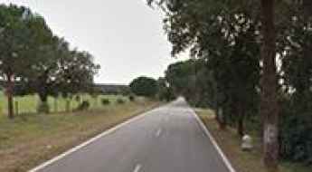
The Atlantic Road, or Estrada Atlântica, is a coastal route in the western part of Portugal. It runs for about 60 km (37 miles) between Nazaré and Praia do Osso da Baleia, near Figueira da Foz, in the Leiria district. The road follows the coastline, offering access to beaches, small villages, and pine forests.
Things to Know Before Driving the Paved Road to Larouco
Larouco is a high mountain peak at an elevation of 1,527m (5,009ft) above sea level, located in Portugal. It is named after a Celtic god, Larauco.
How to drive the steep curves of the EN15 to Alto de Espinho?
Alto de Espinho is a mountain pass at an elevation of 1,025m (3,362ft) above sea level, located in the Norte region of Portugal.
Driving the Scenic EM-509 Road in Serra da Estrela
Estrada Municipal 509 (EM-509) is a very scenic road located in the Castelo Branco district of Portugal. While offering breathtaking views, the road also has a few dangerous sections.
Driving the Wild 4x4 Road to Marao Peak
Marão is a mountain peak at an elevation of 1,413m (4,635ft) above sea level, located on the boundary between the Vila Real and Viseu districts of Portugal.
Driving ‘The Road’ through Enforca Caes
A new coastal road was completed in 2022 in central Portugal. Known informally as “The Road” through Enforca Cães, it runs along the cliffs of Serra de Boa Viagem, providing vehicle and bicycle access between two coastal parishes.
Estrada de Sao Bento: 12% Gradients and Endless Curves — Check Your Brakes!
Estrada de São Bento is a high mountain road located in the Guarda District of Portugal. It’s known as the Portuguese Stelvio Pass.
Driving the scenic EM-508 Road through Serra do Açor
EM-508 is a great driving experience in the heart of Portugal. Located in the Coimbra district, the drive provides stunning views of Serra do Açor.
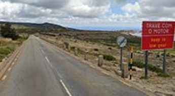
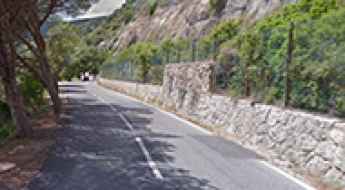
Driving the Algarve Hinterland: Beyond the tourist traps of Albufeira
While most drivers stay on the asphalt of the A22, the real challenge of Southern Portugal lies in the rugged interior of the Algarve. Leaving the tourist hubs of Albufeira behind means facing the Serra de Monchique and the Serra do Caldeirão, where the roads turn into narrow, crumbling ribbons of asphalt and loose gravel. This is a landscape of steep gradients and blind hairpins where mechanical endurance and braking power are the only things that matter.