How to drive the scenic Ryfylke National Tourist?
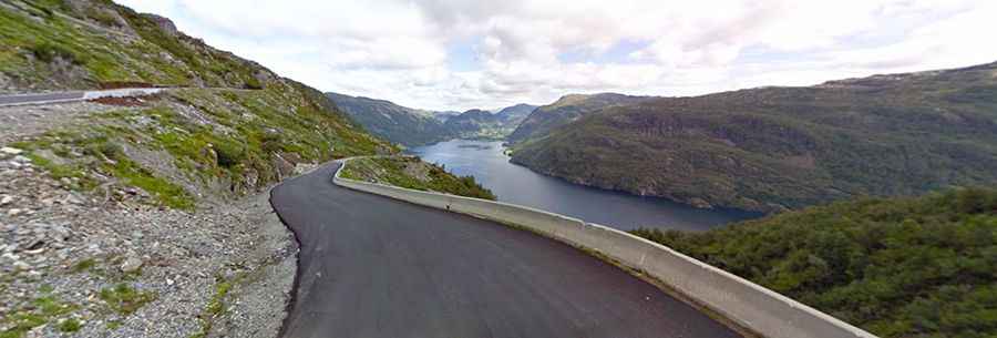
Located in the southern part of Norway, the Ryfylke National Tourist Route is a very scenic drive surrounded by mountains, rockslides, polished cliffs, and fjords. It is one of the most scenic drives in Norway.
How long is Ryfylke National Tourist Route?
The drive is fully paved and comprises Road 520 and Road 13. It’s 260 km (161 miles) long. Sections of the road, particularly over the mountain to Røldal, are narrow with a number of bends. There is currently no maximum length for buses, but the use of shorter buses is advisable.
Where does Ryfylke National Tourist Route start and end?
It runs north-south from Røldal (a village in the municipality of Ullensvang in Vestland county, in the Røldal valley along the Storelva river on the north end of the lake Røldalsvatnet) to Oanes (a small farming village in Strand Municipality in Rogaland county, at the intersection between the Lysefjorden and Høgsfjorden, just north of the village of Forsand).
Is the Ryfylke National Tourist Route worth the drive?
The drive provides stunning views and it’s a must-visit for all driving enthusiasts. It’s a trip full of contrasts.
Is the Ryfylke National Tourist Route open in winter?
The road tops out at 972m (3,188 ft) above sea level. It’s usually closed in the winter in November and reopens in June.
Facts:
Roads: Road 520, Road 13
Length: 260 km
Highest elevation: 972 m asl
Ferries: 2
Winter notice: From Helandsbygd to Røldal is normally closed in the winter in November and reopens in June.
Other: Use of shorter buses is advisable.