Is the scenic Gaularfjellet National Tourist Route worth it?
The Gaularfjellet National Tourist Route is one of the most scenic drives in Norway. Located in the southwestern part of the country, it takes travellers past many waterfalls along the mighty Sognefjord, Norway's longest and deepest fjord.
Is the Gaularfjellet National Tourist Route paved?
The route comprises the roads 55/13/610. It’s fully paved with some narrow sections, and features many curves, a few of them hairpin turns.
How long is the Gaularfjellet National Tourist Route?
The tourist road opened in 1938. It’s 114km (71 miles) long and runs from Balestrand to Sande.
Is the Gaularfjellet National Tourist Route open in winter?
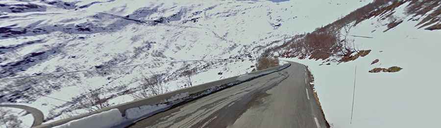
The road tops out at 784m (2,572ft) above sea level. When running over Gaularfjellet, the road is closed during winter from Mel to Mjell.
Is the Gaularfjellet National Tourist Route worth the drive?
It’s an amazing drive through scenic fjords, waterfalls, and mountain landscapes. The drive is exciting and varied, along narrow fjords, on a road up steep mountainsides, over high mountains, and beautiful valleys.
Facts
Roads: Road 55/13/610
Length: 114km
Highest elevation: 784m asl
Ferries: 0
Winter notice: The road over Gaularfjellet is closed during winter from Mel to Mjell.